Trails
+ Easy
0.9 km·25 min·69 m·83 m
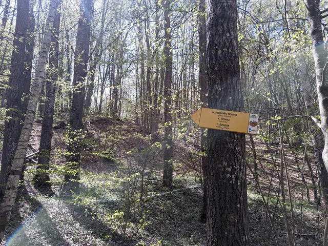
This is a short but varied route. You will pass by two lakes in the Dendrarium area, then descend along a rocky forest path to the Planinishka River, which you will cross over a wooden bridge, and then climb up to the wide and, hopefully, sunny Iglikina Meadow.
Dendrariuma Bus StopIglikina Meadow
 Росен Пантелеев
 Easy
0.99 km·20 min·40 m·51 m
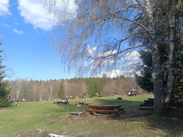
A short walk along an almost level and well-maintained forest path. The meadow in front of Momina Skala Hut is an excellent place for a picnic, which is why it can get quite crowded on weekends.
Momina Skala HutSeptemvri Hut
Росен Пантелеев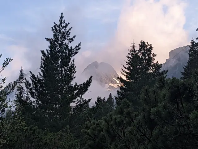 Easy
2.87 km·55 min·276 m·0 m
This is the classic trail to Malyovitsa Hut from the former Central Mountain School (ЦПШ). The trail follows a gravel road, which goes through a coniferous forest along Malyovitsa River. An easy trail, suitable for children.
Hotel AlpinistMalyovitsa Hut
Росен Пантелеев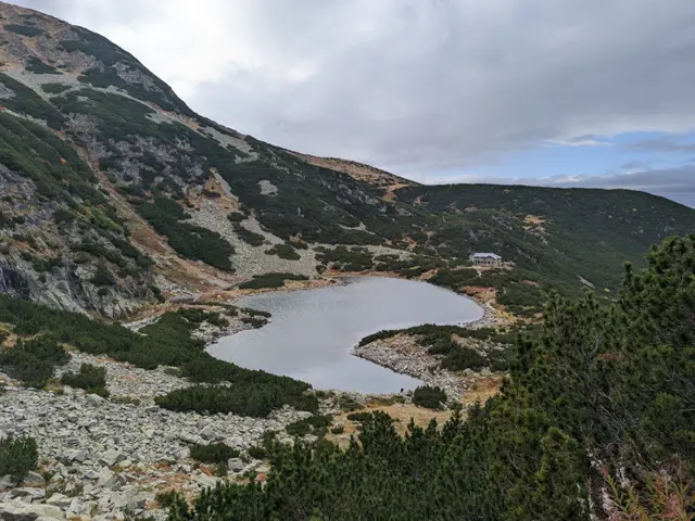 Moderate
2.9 km·1 h 30 min·405 m·3 m
The hike to Belmeken Peak begins with an easy stroll along the shore of Ravnichalsko Lake, which serves as a perfect warm-up for the steep section ahead. But don’t worry - the incline is short, and the rocks underfoot are relatively large and stable. Afterward, we emerge onto a pleasant grassy saddle, offering a bit of time to catch our breath along a nearly flat stretch before the final push to the summit. While this final climb follows a (mostly) grassy path, it is steep-ish and not exactly short. However, once we reach the top, we will be able to see a huge part of the Rila and Rhodope mountains. If we descend slightly down its southeastern slope, we can look down on the Belmeken Reservoir from above. Wild goats are often spotted in the area, and if we get lucky, we might even see the ground squirrel - the elegant cousin of the marmot - whose highest habitat in the Balkans is right here around the peak.
Belmeken HutBelmeken Peak
Росен Пантелеев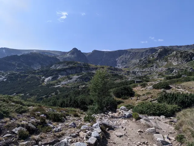 Moderate
1.89 km·45 min·176 m·98 m
Shortly after Rilski Ezera Hut, the trail has a brief, steep section that might seem discouraging. However, once you overcome it, the rest of the route is almost flat. Most of the time, you will see the Dolnoto (Lower) Lake, which will be down to your left. Shortly before reaching Sedemte Ezera Hut, you will cross a small stream, which is actually the Dzherman River - the river into which the Seven Lakes drain. Another climb follows, much shorter this time, and immediately after it, you will find yourself on the shore of the Ribnoto (Fish) Lake, where the hut itself is located.
Rila Lakes LodgeSedemte Ezera Hut
Росен Пантелеев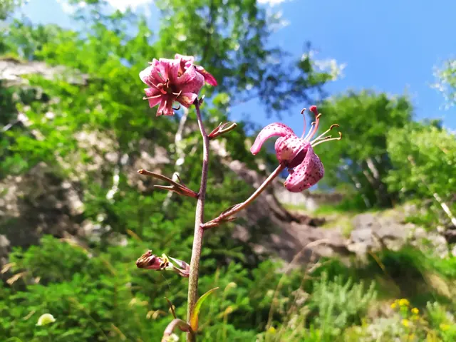 Moderate
11.66 km·3 h·806 m·36 m
Ribni Ezera (Fish Lakes) Hut is most frequently accessed from the Tiha Rila canton, as a dirt road suitable for off-road vehicles reaches it from Kirilova Polyana. From there to the hut, it takes only about an hour along a steep but well-marked trail through dwarf pine and small meadows. The asphalt road ends at Kirilova Polyana, so it is possible to leave your car there and walk along the dirt road to Tiha Rila on foot, as described here. Kirilova Polyana and Tiha Rila are located in a valley with little wind and plenty of water, so it is a good idea to stock up on repellent against the mosquitoes, which are found in abundance there.
Kirilova PolyanaRibni Ezera Hut
Росен Пантелеев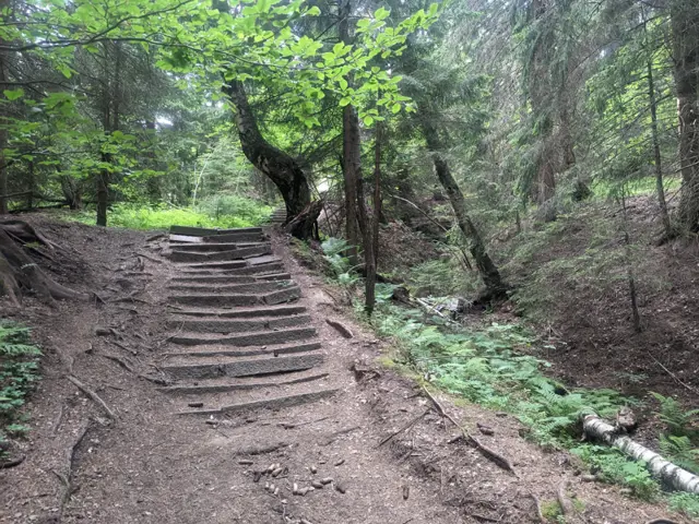 Easy
1.28 km·20 min·109 m·20 m
From the bus stop at Zlatnite Mostove, you walk along the asphalt road for about ten minutes. After two large bends, you take a forest path that branches off to the right from the road. Its second half is steep, but stone steps have been built to make it easier. This path leads to the wide meadow in front of the hut.
Zlatnite MostoveKompozitorite Hut
Росен Пантелеев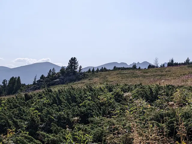 Moderate
2.91 km·1 h 14 min·289 m·35 m
This is one of the options for the trek from Skakavitsa Hut to Rilski Ezera (Rila Lakes) Hut. The trail markings are abundant at first, but after the first junction, they become unclear and start to fade. This is quite important, as there is no shortage of misleading detours and less-than-obvious turns. Nevertheless, the route is completely passable, and if you use a navigation app or a GPS device to help you along, you shouldn't run into any problems.
Skakavitsa HutRila Lakes Lodge
Росен Пантелеев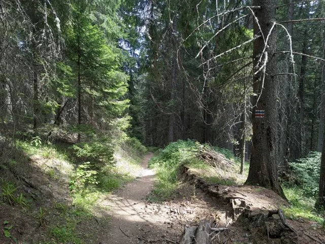 Moderate
2.87 km·1 h·32 m·256 m
A trail through the forest, suitable for both summer and winter. If you are in the meadow in front of Lovna Hut, you need to go around the building from the right, and at the edge of the forest there, you will see the sign for Vada Hut. Head into the forest and pass by the water turbine that supplies the hut with electricity. The Dzherman River will be on your right, which you will soon cross via a small wooden bridge. After the bridge, there is a short ascent through the forest, after which you will descend to one of the many dirt roads in this part of the Rila Mountains. You turn right along this road and keep following it until you reach the first left turn, where you will find trail signs and an information board. There, continue straight through the forest on either of the two paths ahead of you - the left path is gentler, and the official trail markings follow it, but judging by how not-really-well-trodden it is, people seem to prefer the steep path that climbs straight up. After a short and steep climb, you will emerge at the junction where our trail merges with the blue markings coming from the Seven Lakes Hut. Continue straight ahead along the dirt road that descends steeply through the forest, and follow it until you reach the small bridge over the river next to Vada Hut. This is the Pravi (Straight) Iskar River - one of the many tributaries of the Iskar River. Shortly after the bridge, you will see the hut itself.
Lovna HutVada Hut
Росен Пантелеев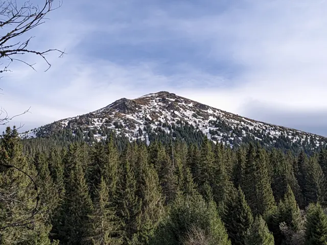 Moderate
10.16 km·3 h·122 m·1139 m
The trail is quite steep in the section from Vezhen Hut to the fork for Benkovski Hut.
Vezhen HutTurnoff for Vezhen Hut and Benkovski Hut
Росен Пантелеев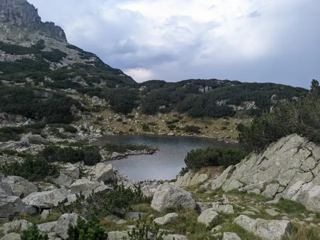 Moderate
7.05 km·3 h·280 m·576 m
This is one of the faster options for descending from Tevno Ezero Shelter if you plan to catch the lift from Bezbog Hut afterward. The trail is varied but mostly rocky, and the section from the Left Kraledvor Gate to the Samodivski (Kraledvorski) Lakes is very rocky with loose, unstable boulders. Just when you reach Popovo Lake and think the hard part is over, the final ascent and descent to Bezbog Hut will prove you wrong.
Tevno Ezero ShelterBezbog Hut
Росен Пантелеев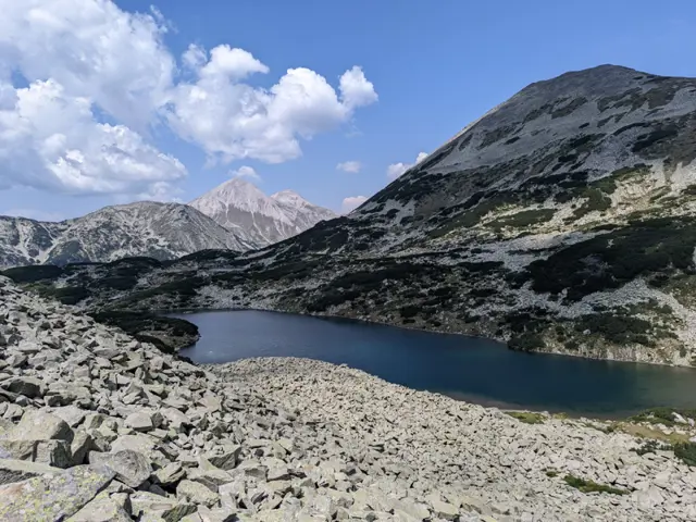 Hard
10.73 km·7 h·951 m·399 m
The route from Vihren Hut to Tevno Ezero Shelter via the Tipik peaks is part of the E4 European long-distance path. It is a long high-ridge traverse in the central part of the mountain and, in good weather, offers views of dozens of glacial lakes as it passes alongside or above the Banderishki, Vasilashki, Tipitski, Bashliiski, Chairski, Valyavishki, Prevalski lake groups, ending at the largest of the Malokamenishki lakes - Tevno Ezero. The terrain is alpine throughout, and the peaks the trail crosses or looks out upon are rocky, with grassy sections and occasional juniper and dwarf pine. The total elevation gain is under 1,000 meters, but because the ground is often stony and walking on large, frequently shifting rocks is tiring, the hike requires decent physical endurance. After Bashliyska Porta, there is no water along the main ridge, which makes up the greater part of the hike, so it is a good idea to stock up on plenty before you set off. The section at Tipik peaks is known as "Malkoto Konche" (The Little Horse), drawing a parallel to the knife-edge ridge between Kutelo and Banski Suhodol peaks. The ridge narrows significantly here, but unlike the actual Koncheto, the trail here is not secured with a safety cable. However, this shouldn't deter you, as the more dangerous sections are primarily on the eastern slope of the ridge; therefore, your goal should be to stick to the western side wherever possible. Start of the Route The route begins with a short but fairly steep climb from the parking lot in front of Vihren Hut toward the meadow located southwest of the hut. It then continues through a short section overgrown with dwarf mountain pine until it reaches the small wooden bridge over the Banderitsa River. Along this section, our trail ,marked with red stripes, overlaps with the blue-marked trail leading to Sinanitsa Hut, but the two paths split just before the bridge. We cross the bridge and continue toward the Banderishki Lakes, the first of which is only a five-minute walk away. Okoto Lake After the bridge, there is a sign pointing to the left of the main trail. The short detour it marks will lead us to the small Okoto Lake (The Eye), the first of the Banderitsa Lakes group. It is nestled in a relatively isolated cirque saddle, so when we visit it, we will feel as though we are deep in the mountains, despite actually still being quite close to civilization. The lake reflects the silhouette of the peak Banderishki Chukar, whose pyramidal shape is clearly visible from our vantage point. The Banderitsa Lakes After a short stroll along the right shore of Okoto Lake, we head back down to the main trail. At first, the path runs through the meadow along the river, but it soon begins to gain elevation as the terrain becomes rockier. The next lake in the group, Ribno (The Fish Lake), will appear on our right. Reaching it requires a brief detour from the route. Given that a long and difficult trek lies ahead, we should carefully consider whether we have the energy for such detours by the time we reach the junction for this lake, especially since a little more climbing along our path will soon grant us a view of it from above. There will be no shortage of lakes along the way. As we ascend a bit further, a portion of Ribno Banderishko Lake will reveal itself among the rocks and dwarf mountain pine below us - the detour for which I assume we bypassed. After another 200 meters of elevation gain, the steep trail brings us to the third Banderitshko lake along our route: Zhabeshkoto (The Frog Lake). Here, our path branches off to the right, while the green-marked trail continues straight toward Demyanitsa Hut via Todorina Porta (Todorina Gate). To our right stands the peak Banderishki Chukar, and behind us, on the other side of the Banderitsa River valley, rises another pyramidal peak - Muratov. A short descent follows, bringing us to the shore of Dalgoto (The Long) Banderishko Lake. Beyond this lake, the truly difficult section begins. The Ascent to Bashliyska Porta A steep climb awaits us along a path that can hardly be called a path. We walk over rocks, huge boulders, until we reach the foot of Vazela Peak. Although various guidebooks state that the trail passes through Bashliyska Porta (Bashliyska Gate), the lowest part of the saddle will actually be off to our right, some distance away. Instead, our path will lead us out about a hundred meters below Vazela Peak, where the massive rocks finally end, and the terrain becomes significantly more pleasant and gentle. While we are still going up, however, it is well worth turning around from time to time. Even though this section is physically grueling, it offers, at least for me, the most beautiful view of the entire route: the white peaks of Vihren and Kutelo, the Todorka Ridge to their right, and the Banderishki Lakes below us. Opreno Peak and the Tipitsite From here all the way to Mozgovishka Porta, we walk along the ridge. The terrain varies from boulder fields to grassy meadows, with lakes visible in every direction. For instance, as we approach the next peak, Opreno, we will see a massive lake down to our left. This is the largest of the Vasilashki Lakes - Tevno Lake. Not that Tevno Lake toward which our trail is heading, but Tevno Vasilashko Lake. Although our path doesn't cross every single high point along the ridge, we can always take brief detours if we have the energy to see what lies on the other side, as there is certainly no shortage of interesting sights. Before reaching the first peak of the Tipits group - Golyam Tipits (or Golyam Tipik), we will notice thin, flat rocks appearing along our path. They protrude from the ground, strangely arranged compared to the chaotic rock piles surrounding them. Whether this is a natural phenomenon or the whim of a tourist whose example others followed, I do not know, but it is the only place along the route where you will see it. Malkoto Konche (The Little Little Horse, the duplication is not a mistake) Next is the descent toward the most famous section - the narrow, rocky ridgecrest between Golyam and Malak Tipits, known as Malkoto Konche. Malkoto Konche is a diminutive of a diminutive, since the original ridge Koncheto, after which this one is named, already means The Little Horse, so this one is the little version of the little horse. Not to scare you, but there is no shortage of places where one could fall here. On the other hand, the dangerous sections are brief, and as I mentioned before, if we stick to the trail markings and avoid the detours that go along the left side of the rocky ridge, where the cliffs drop down to the Tipitski Cirque with the Tipitski Lakes below us, we shouldn't have any problems. Prevalski Chukar, Prevala Saddle, and Mozgovishka Porta After the Tipits Peaks, the trail becomes less technically demanding, though it remains physically testing. We will descend a bit, climb back up slightly to Prevalski Chukar, and then descend once again - this time to Prevala, the saddle that separates the Chairski and Prevalski glacial cirques. Here, off to our right, we will spot the Chairski Lakes. Down to our left will be the Prevalski Lakes, and further out, also to the left, the Vasilashki Lakes. I don’t recall exactly which lakes are visible from which precise vantage point, but in this part of Pirin, you certainly won't find any shortage of lakes. Here, a trail branches off to the left from our path, heading toward the Prevalski cirque and Demyanitsa Hut, as well as to the right - passing by the Chairski Lakes toward the Spano Pole Shelter. We continue straight ahead. Next, we skirt around Mozgovishki Chukar, the peak straight ahead of us, traversing its rocky northeastern slope toward the saddle between it and the peak visible to the left, the lower twin of Valyavishki Chukar, which is marked on some maps as Valyavishka Chuka. This saddle is Mozgovishka Porta (Mozgovishka Gate). The Belemeto Cirque, Kamenitsa Peak, and Tevno Lake Once we pass through Mozgovishka Porta, we don't have much further to go until Tevno Lake. Here, a blue-marked trail branches off from our path, heading south toward Begovitsa Hut and north toward Demyanitsa Hut. The red-marked trail, which we continue to follow, skirts around Valyavishka Chuka, and before long, the steep, rocky slope gives way to grassy meadows. Granted, there are still rocks scattered about, but grass begins to dominate the landscape. Kamenitsa Peak comes clearly into view, and after a little more walking, so does Tevno Lake - the largest in the Belemeto cirque. At its far end sits our final destination: the Tevno Ezero Shelter.
Vihren HutTevno Ezero Shelter
Росен Пантелеев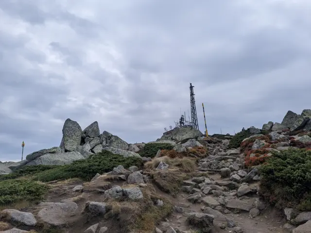 Moderate
3.39 km·1 h 30 min·519 m·40 m
This is the summer route to Cherni Vrah from Aleko Hut, which is also known as "the trail through the Wall" (Stenata). It is famous for its steep first half, but that is only because most people head straight up along the shortcuts worn down by descending hikers, or along the ski run, instead of following the switchbacks where the official trail markings go. If you follow the markings, your climb will be much easier. The GPX track here was recorded along the gentler, marked switchbacks. The route begins at the meadow in front of Aleko Hut, just past the water fountain, where the trail uphill is clearly visible. From there, we gradually gain altitude, with Malak Rezen peak appearing on the left and the two peaks of Ushite visible in the distance on the right. We pass an abandoned building which, according to the BgMountains map, is the former top station of the "Zaeka" (The Rabbit) ski lift. There is a water fountain next to it that runs all summer long. Once we reach the fork where our trail merges with the dirt road and the pole markings alongside it, we will catch our first glimpse of the summit. We walk along the dirt road for about ten minutes and then branch off to the right, following the winter pole markings - at this point, the winter and summer trails coincide. First, we descend to the small bed of a little stream, crossing it over a wooden bridge. After that, the trail splits into several paths running roughly parallel to each other. In some spots, it is necessary to bypass marshy areas that change position and size depending on the season, so the variety of paths is quite helpful. Once we reach the teahouse and the meadow in front of it, we are almost at the top. This is where the route ends for most people, but if you are an enthusiast, you can climb up to the actual highest point of Vitosha—the pile of large boulders about fifty meters from the teahouse. From there, we can look down on the other hikers.
Aleko HutCherni Vrah (Black Peak)
Росен Пантелеев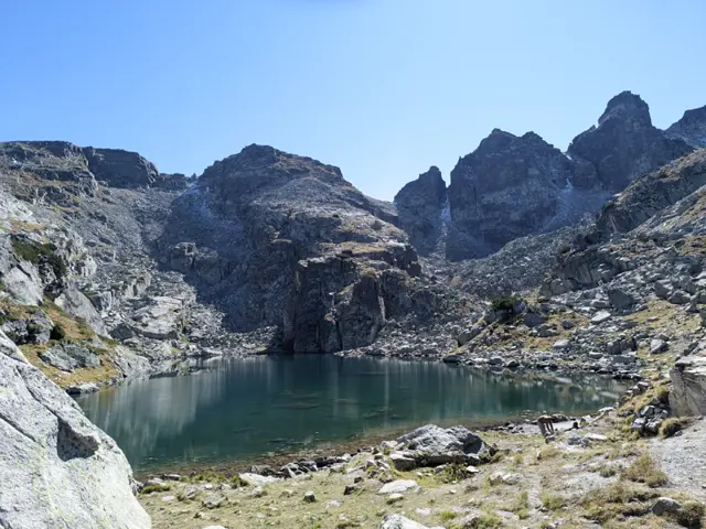 Hard
3.38 km·2 h 30 min·505 m·39 m
The route begins behind the corner of the Malyovitsa Hut, looking from the benches in front of it toward the peak (see the photo with the arrow). Head across the meadow toward the river and find a convenient spot to cross it, then follow the trail markings through the dwarf pine. You will cross several boulder fields (stone rivers), where you need to follow the markings closely, as the spots where the trail re-enters the next sections of dwarf pine are not completely obvious. Navigating the rocky sections might feel tedious, but it is nothing compared to the passage ahead - namely, a very steep climb through the dwarf pine alongside the Malka Malyovitsa stream. In some spots here, the slope is so steep that you may need to grab onto the surrounding dwarf pine branches. To top it all off, the proximity of the stream on the left means there is no shortage of muddy patches. Parts of this section freeze over during the autumn months, so it is wise to consider how you will come back down before you go up, lest your hike turn into an unwanted bobsled session. Once you clear the steep climb, it is relatively easy from there. Sure, there is more steep ascent ahead, but it isn’t nearly as brutal. First, you will emerge onto a flat, rocky field with the stream flowing underneath it, and after some more dwarf pine, you will reach a wide meadow. To your left is the Razhdavitsa ridge, and ahead you will see the northern faces of Kamilata Peak and Lovnica Peak behind it. Afterward, you will have to tackle one more climb - the southern end of Razhdavitsa - before descending toward the first lake along your path. This lake, much like most of the others in the area, does not have an official name (as far as I know), but collectively all of them - including Strashnoto Ezero (The Scary Lake) - are known as the Prekorechki (or Gornoprekorechki) Lakes, as they are the source of the river Gorna Preka Reka. From this lake, head upward once again - this is the penultimate climb of the route, leading you to the next lake. This lake is large and blue, so you might think you have reached your destination. You haven't. There is one final climb. Only after clearing it will you see Strashnoto Ezero and the shelter on the left.
Malyovitsa HutStrashnoto Lake
Росен Пантелеев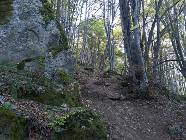 Hard
2.2 km·1 h 20 min·388 m·0 m
The trail from the Dragalevtsi Monastery to the Kikish Shelter is notoriously steep, so do not expect to encounter many people along the way. However, it is relatively short, passing through a beautiful beech forest and leading past massive boulders sitting right beside the path, making the trail not entirely uninteresting.
Bus Stop "Turnoff for Dragalevski Monastery"Kikish Peak
Росен Пантелеев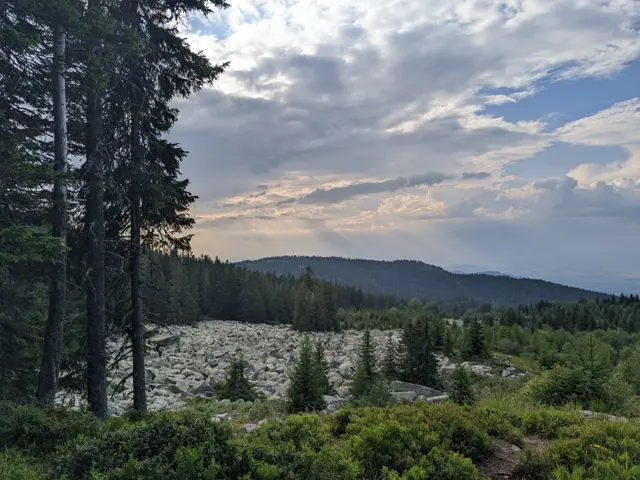 Moderate
2.17 km·45 min·58 m·25 m
The trail from Edelweiss Hut to Kumata Hut is short, almost flat, but very diverse. We will walk through a forest, past stone rivers and meadows with views of the mountains in the Kraishte region (northwest of Vitosha), finally crossing the Vladayska River at a spot where it forms a wide pool among large, rounded boulders. The route is most enjoyable during the warmer months, because the trail is not very popular and the markings are sparse, so it is easy to get lost in winter when fresh snow has fallen, and deep snowdrifts tend to form in the open sections.
Edelweiss HutKumata Hut
Росен Пантелеев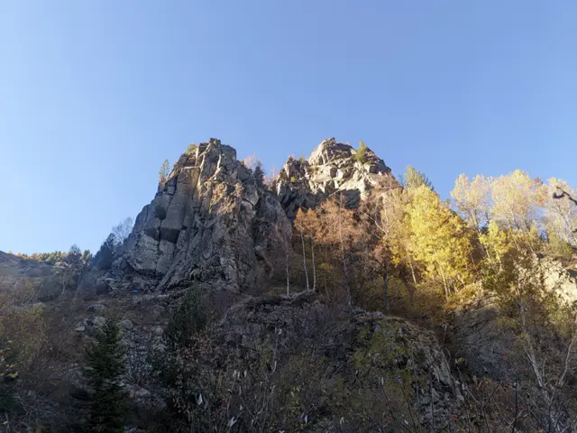 Hard
3.23 km·1 h 18 min·515 m·8 m
The path from Bay Krastyo Shelter to the plateau via Kominite is one of the more difficult routes on Vitosha Mountain. There are many spots where you can get lost, steep stony sections where a fall cannot be ruled out, and it is not very popular, so we are likely to have it to ourselves, especially on weekdays. However, it will take us through one of the few alpine sections of otherwise rounded and welcoming Vitosha, with landscapes that will remind us more of Rila and Pirin. We will also have the chance to climb to the highest point of Kominite, which has a short detour off our path. The area around Kominite is prone to avalanches, so the path is only suitable for months when there is no snow up there. We start from the sharp bend that the paved road to Aleko Hut makes at the bus stop for Bay Krastyo Shelter. If you are driving, there is a roadside pull-off next to the bus stop where you can park. We need to be careful at the turn because the last time I went (October 2026), the detour from the road, where the trail starts, was blocked by fallen trees and, to make it completely confusing, there was a fresh ditch dug between the road and the start of the path, so it looks impassable there. There are also a few alternative paths we might accidentally take, so we need to keep a close eye out for the trail markers. Once we enter the forest, the path becomes relatively easy to follow. After a gentle climb through the beech forest, we will come out at the valley of the upper course of the Dragalevska River (which is a relatively small stream there), from where we will catch our first glimpse of the stone towers of Kominite (The Chimneys) on the right. We will have to cross the river. Here the valley is deep and shaded for most of the day, so during the autumn months the path and the stones we use to cross the river may be iced over. There is a bridge, but it is in very poor condition and unusable (as of October 2026). After the river, we have two options: one is to head along the left "chimney", where a path climbs steeply upwards. The other is to loop around to the left, initially towards the grassy gully we will see to the east in front of us, but before reaching it, we turn right again. This option is gentler, but it is easy to get lost and people sometimes head straight east up the gully where there is no path. Therefore, the current GPX follows the steeper, more unambiguous version of the path. Shortly before we climb up to the rocks above the left "Chimney", we will see a detour to the right that runs alongside a stone scree. Along it, we can climb to a group of large boulders that represent the highest part of Kominite. We can also continue and we will see another, gentler detour to the same place. But whichever option we choose, climbing the rock formation is dangerous, so if we are not confident in our abilities, we can simply continue along the path towards the plateau. The path to the plateau continues upward through a sparse grove of birch trees and bushes, then emerges at a junction with several signs, where a path descends northwest towards Kikish Shelter. We continue climbing up the grassy slopes before the plateau. We will pass Manova Cheshma (Manov's Water Fountain) and come out onto the wide path across the plateau marked with numbered posts, along which we will reach Ushite Shelter in about ten minutes. To climb to Ushite Peak, we must pass the shelter and, a few meters behind it, turn left towards the peak. The little path will lead us to the grassy clearing between the stone piles at the top. From Ushite Shelter, we can continue towards Zlatnite Mostove and Momina Skala Hut, or head back across the plateau towards Aleko Hut.
Bai Krastyo ShelterUshite Peak
Росен Пантелеев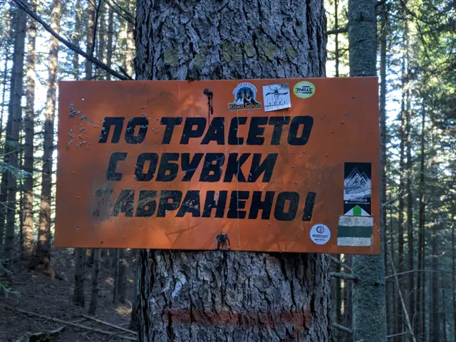 Hard
4.6 km·2 h·587 m·3 m
The trail from Govedartsi to Mechit Hut starts from the villa zone near the ski slope, where there is a wider section of the road used for parking. You can reach the villa zone by car, or you can come by public transport—minibuses depart from Samokov bus station to Govedartsi several times a day. If you are coming by minibus from Samokov, you will first need to walk to the villa zone. Get off at the last stop in Govedartsi (in the direction of Malyovitsa), and then take the asphalt road that branches off to the left from the main road to Malyovitsa. Once you reach the intersection with Vasil Kolarov Street coming from the center of Govedartsi, turn right and keep walking along the asphalt road. After a while, you will see the first green stripes of the color marking. At the parking area before the ski slope, the road turns right towards it, but you will take the dirt road that continues straight ahead. There are other ways to climb up to the hut from here (for example, by turning right, passing the ski slope, and following the dirt road all the way to the top), but in the route described here, I have tried to follow the official marked trail as much as possible. Once you enter the forest, you just need to follow the GPS track. As of 11.2026, the marking is in very poor condition and there are forks everywhere, but most of them will lead you to the hut, so even if you are not quite on the marked trail, it won't be a disaster. There are steep sections along the trail (especially at the beginning), and around the middle you reach the ski slope, which you walk along for a bit. There, you will cross the dirt road coming from Govedartsi and then continue up the ski slope. At the top of the slope, the road and the trail markings merge and continue together to the hut. However, pay close attention here - once you reach the road past the end of the slope, you will see a fork. You need to take the right branch, as another dirt road splits off to the left and leads to the village of Mala Tsarkva instead of the hut.
Last Bus Stop in the Village of GovedartsiMechit Hut
Росен Пантелеев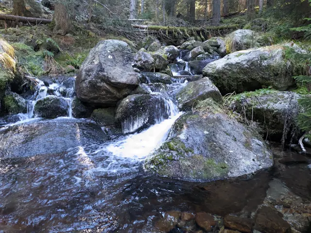 Moderate
9.76 km·3 h 30 min·391 m·445 m
The trail through the Ovnarsko area is the shorter and physically easier option for hiking from Mechit Hut to the Malyovitsa resort. You walk through the forest the entire time, often on flat ground, and cross several streams descending from the cirques below Lopushki Peak and the Kupenite peaks. The alternative is the ridge route over Mechit and Lopushki peaks, which is much more scenic, but involves considerable distance and elevation gain. However, if you choose the trail through Ovnarsko, you must definitely carry a GPS with you, as the route passes through numerous logging areas, is intersected by dozens of dirt roads, and rarely has signposts at junctions. In places, the trail markings have been destroyed by logging, and most of the dirt roads are new and do not appear on maps. You will even pass a junction where six logging roads meet with no markings at all. The trail starts right across from the entrance of the old building at Mechit Hut, where you can also spot the first red trail blazes. At the beginning, you descend through the forest, and then, at the entrance to the national park, a short climb begins. This is also where the first fork is - just before the signs marking the start of the national park, your forest path merges diagonally with a dirt road coming in from the right. You will walk along this road for a little over half a kilometer before reaching a second fork, where you need to leave the road. Although the path heading right and downhill here is much narrower than the road and not easy to spot among the trees, there are several signposts and visible markings that clearly show the way. This trail will lead you to the first river on the route - Golyama Lopushnitsa, which starts from the northeastern foothills of Lopushki Peak. Next comes a relatively flat section through the forest, crossing one or two smaller streams. About half a kilometer from the fork where you left the road, you will emerge onto a forest clearing where the path may be hard to see in the tall grass, making it tricky to tell where the trail continues into the woods on the opposite side. On the BgMountains map, this meadow is marked as "Mlakoto Torishte" (Little Dunghill). The navigation challenges up to this point are minor compared to what lies ahead. After roughly another kilometer, you will cross Malka Lopushnitsa, which flows from the Lopushki Lakes. After the river, the section of the national park you’ve been walking through ends, and from here on you will be going through unprotected territory all the way to the Malyovitsa resort. Soon you will see the first felled trees, and the path turns into a wider dirt road. Here, the effects of logging become increasingly visible, landmarks in the scenery become less reliable, and the dirt roads multiply and branch out more and more. The last fork where trail markings still remain is just before Ovnarsko. Your trail turns right, perpendicular to the dirt road you are on, and heads straight down through a clear-cut - a swath cut through the forest surrounded by fallen trunks. The descent here is very steep for about 300 meters, after which the trail branches off to the left of the clearing. This turnoff is easy to miss, so it is a good idea to keep an eye on your GPS device. After another 50 meters or so along this turnoff, you will step out onto an asphalt road. This is the Ovnarsko area, where there are bungalows (somewhere in the forest around) and the ruins of former buildings. Today, these dilapidated asphalt roads appear to be used by loggers. To the left of the asphalt road, shortly after you start walking along it, there is a pull-out marked as a parking area on the BgMountains map. At one end of it stands a well-maintained drinking fountain, where I even saw a bar of soap left there. Further down, the road makes several bends, passes another working fountain, and leads out to that six-way junction mentioned earlier. How do you navigate that junction? Even with a GPS, it can be tricky because the branching roads are close together and the satellite signal in the forest may not be very strong. So here is a tip valid as of November 2026: as you enter the junction, you will see a wooden table with two benches on your left. Pass it and take the second fork to the left after it. About 50 meters down this dirt road, you will spot the trail markings again, now consisting of two colors - your red trail and the blue trail coming from Govedartsi. Beyond this point, it is impossible to describe which way to turn at every fork, as the junctions and roads simply become too numerous. You will successively cross Gorna Preka River, Sredna Preka River, and Dolna Preka River, which originate from the foothills of Popova Kapa and the lakes in the Strashnoto Lake area. After passing Sredna Preka River, the blue trail branches off to the left and uphill at one of the junctions - it leads to Yonchevo Lake, where Sredna Preka River begins. After more forks and new dirt roads that are not on the map, you will need to turn left off the dirt road you are following and continue along a forest footpath. Here, the markings become clearer again, though you will soon reach more logging places and dirt roads. Finally, just before the Malyovitsa complex, you will walk for half a kilometer along a very wide ski track, from which - as compensation for the logging areas you passed through - a view of Malyovitsa Peak opens up for the very first time.
Mechit HutHotel Alpinist
Росен Пантелеев Moderate
3.94 km·1 h 42 min·0 m·507 m
We head towards Rilski Ezera (Rila Lakes) Hut, and just before the small stream coming down from Trilistnika (The Trefoil) Lake, we detour to the right, following the green and yellow trail markings. There are three easy ways to get confused here: The detour is hidden among dwarf pine, so it is not very easy to spot. There is another detour before it which leads along an unmarked path straight to Dolnoto (The Lower) Lake. If we take that one, we will have to find a way to navigate to the left through the puddles and streams filling the meadows along the lakeshore in order to catch the green/yellow trail to Lovna Hut. If we still end up by the lakeshore, we must be careful not to take the blue trail, which goes towards Vada Hut. Afterwards, we simply follow our trail down along the Dzherman River, enter the forest, and walk through it until we reach the junction where the yellow and green markings split. We need to take the right turn following the green trail. The detour is poorly marked and can easily be missed, so once we enter the forest, we must carefully watch the color of the trail markers on the trees. A steep descent follows, and after about fifteen minutes, we come out onto the meadow in front of Lovna Hut.
Sedemte Ezera HutLovna Hut
Росен Пантелеев