Places
+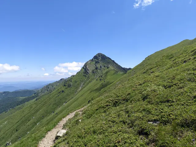
Golyam Kupen Peak
2169 mGolyam Kupen is one of the more difficult peaks to climb in the Balkan Mountains. The paths to it - both from its eastern and western sides - are secured with steel ropes. The peak is a key point on the famous Dobrila - Botev alpine traverse, which itself is part of the longest hiking route in Bulgaria, Kom - Emine.
 Росен Пантелеев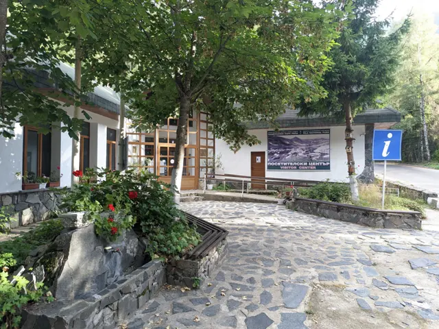
Visitor Center of Rila National Park, including a museum with a rich collection of minerals and a three-dimensional model of Rila.
Росен Пантелеев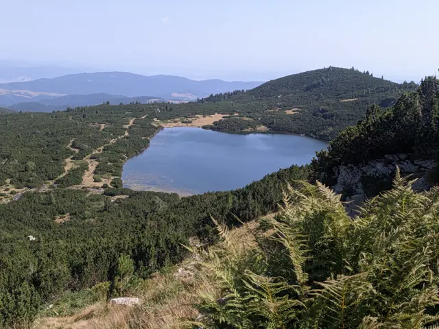
The Lower Lake is the seventh of the Seven Rila Lakes. It is located at the lowest altitude of them all, which is why it was given the most logical name for its position—Dolnoto Ezero means The Lower Lake in Bulgarian. In the Bulgarian mountains, there are many lakes with unique names. Just within the boundaries of the Rila mountains, we can visit The Pig Lake (Svinskoto Ezero), The Stinking Lake (Smradlivoto Ezero), and The Maggoty Lake (Chervivoto Ezero). Compared to these, The Lower Lake does not exactly boast an impressive name. The lake is 11 meters deep. The waters of the other six lakes flow into it, and the lake itself is the source of the Dzherman River.
Росен Пантелеев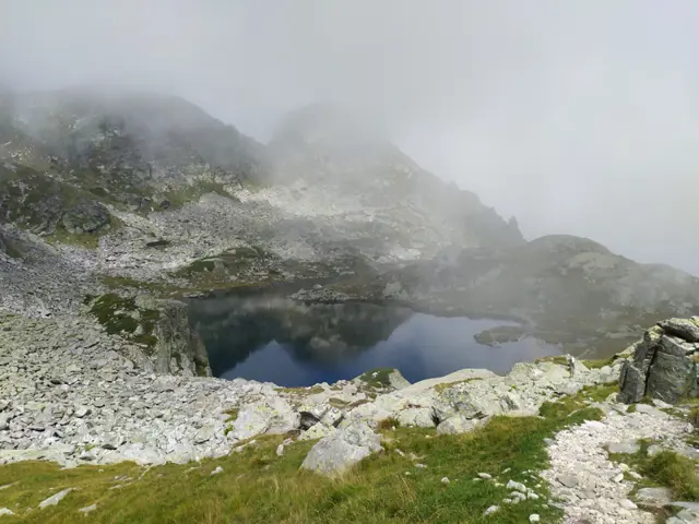
Elenino Lake
2479 mElenino Lake is the largest and most famous of the group of three Elenski (Elenini) Lakes. It is located east of Malyovitsa Peak, right at its foot. The marked trail to the peak from Malyovitsa Hut passes by its shore.
Росен Пантелеев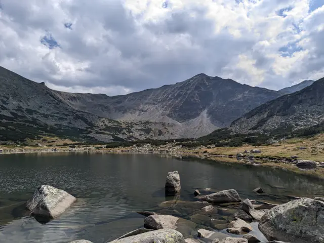
Lower Musala Lake
2389 mLocated right in front of the Musala Hut, the Lower Musala Lake is the lowest of the seven Musala lakes. In the summer, clumps of fireweed bloom along its shore, and schools of small fish can be spotted in its shallow pools. Its area is 13.4 decares and it is 1.6 meters deep.
Росен Пантелеев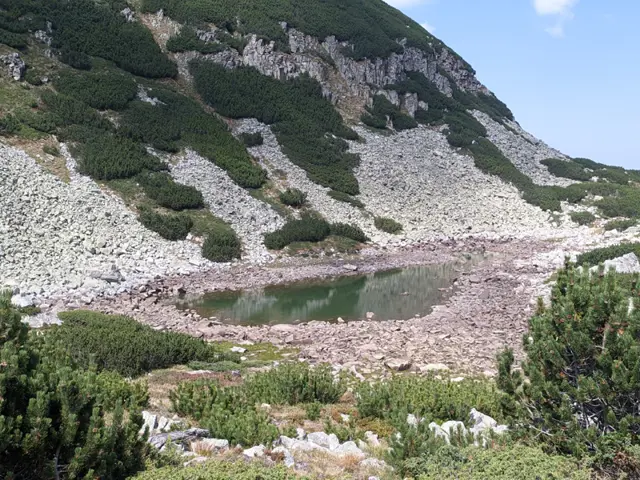
Ferdinandovo Lake
2486 mThis is the fourth Musala Lake. In the summer, its water surface area shrinks significantly, but its actual size can be seen from the dark stones from the lakebed, which remain dry on the shore and stand out against the much lighter surrounding rocks.
Росен Пантелеев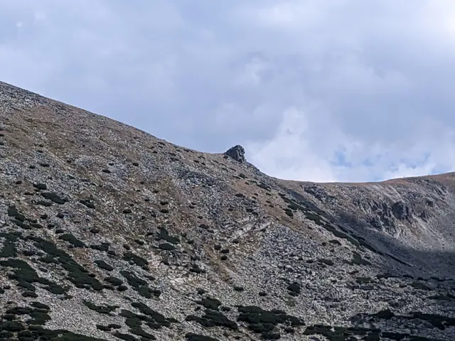
The Sphinx
2700 mThe Sphinx is a rock formation resembling (controversially) the famous guardian of the pyramids in Giza. It is located in the saddle between Deno and Irechek peaks, and is clearly visible from Musala Hut, as well as from a large part of the main trail to Musala Peak.
Росен Пантелеев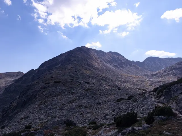
Irechek Peak
2852 mIrechek Peak is located on the main Musala ridge. It is the high, steep peak visible directly ahead of Musala Hut, which is why first-time visitors to the area often mistake it for Musala Peak itself. The peak is named after Konstantin Jireček, a Czech historian and author of the first comprehensive scientific history of the Bulgarians.
Росен Пантелеев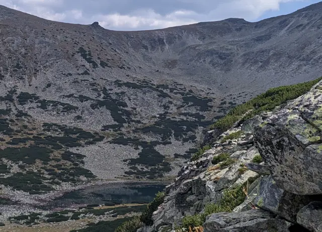
Karakashevo Lake
2393 mKarakashevo Lake is the fifth (from top to bottom) and the largest of the Musala Lakes group. It is located at the foot of Irechek Peak, within the same cirque basin between the peak and Musala Hut that also holds the Lower (seventh) Musala Lake and the small Sixth Musala Lake, which sits between the other two.
Росен Пантелеев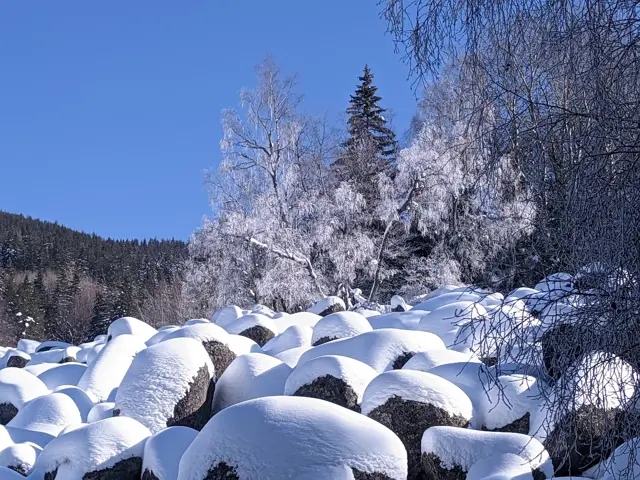
Zlatnite Mostove
1405 m"Zlatnite Mostove" (The Golden Bridges) is the largest stone river on Vitosha Mountain. It is located at an altitude of 1,350 to 1,500 meters, and beneath its rocks flows the Vladayska River - the very same one that flows under the Lions' Bridge in Sofia. Some people wonder about this, so let me clarify: the Golden Bridges are neither golden, nor are they actually bridges. Yes, it often happens that someone stands right in front of them and asks where the bridges are. According to Wikipedia, the golden color in the name comes from the color of the lichens on the stones, but to me, the lichens look more like green, so I don't know. However, an interesting fact is that the figurative name of the area still holds a fraction of literal truth — there are very real golden grains in the sands of the Vladayska River, which flows under the Bridges. They are very rare, but they do exist. If you look closely at the sand at the bottom, especially on a sunny day, you will see golden glittering particles. That is not gold. That is mica, which is light and floats to the very top of the sand. Gold is heavy and sinks. You won't see it. The Golden Bridges are a stone river (or a stone run). A stone river simply means a long scree of large rocks, beneath which a river may or may not flow. The Golden Bridges happen to be a stone river that an actual river runs underneath.
Росен Пантелеев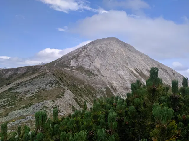
Vihren Peak
2914 mMount Vihren is the highest peak in Pirin, the second-highest peak in Bulgaria, and the third-highest on the Balkan Peninsula after Mytikas in Mount Olympus. It is located on the main Pirin ridge between the peaks of Kutelo and Hvoynati Vrah. Vihren is also the first peak along the marble section of the ridge when heading northwest. Its white pyramid is visible from a large part of the mountain, often alongside the other large pyramid next to it - that of neighboring Kutelo. It is accessible via marked trails from Vihren Hut, which is located at its foot. Marble does not retain water, which is why the vegetation along the marble ridge and Mount Vihren is far from abundant. Yet it includes some rare plants, such as the edelweiss. By the way, the edelweiss, which you can sometimes encounter right on the marked trails, is strictly forbidden to pick. Chamois live around the peak; they are used to the heavy flow of tourists and are not disturbed by their presence, so you may have a chance to photograph them from a relatively close distance.
Росен Пантелеев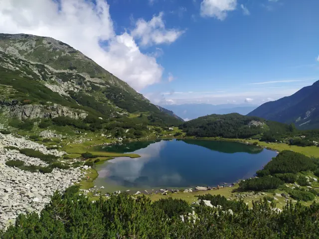
Muratovo Lake
2230 mOften called the "Heart of Pirin" because of its characteristic shape, Muratovo Lake is one of the most popular places to visit near Vihren Hut, accessible to beginner hikers. It is located under the pyramid of Muratov Peak on the trail leading from Vihren hut through Banderishka Gate to Sinanitsa Hut. There is a small meadow next to the lake, and only further up the trail to the gate can you visit the other, smaller lakes from the group to which Muratovo Lake itself belongs - the Ovinati (Hvoynati) Lakes.
Росен Пантелеев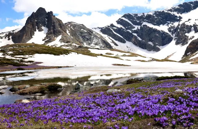
Haramiyata Peak
2465 mHaramiya Peak (also known as Hayduta) is the sharp peak visible from almost every spot around the Seven Rila Lakes. The Trilistnika (Trefoil) and Bliznaka (Twin) lakes lie to its west, while the Upper Chanakgyol Lake - which the followers of the White Brotherhood call the Lake of Purity - is located to its east.
Росен Пантелеев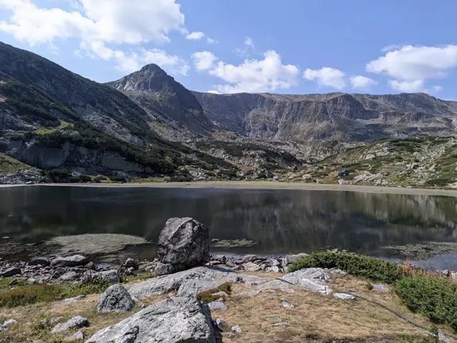
Ribnoto Lake (literally "The Fish Lake") is the sixth of the Seven Rila Lakes. It is the shallowest lake in the group, with an average depth of 1.10 meters. Due to its shallow waters, the lake warms up quickly during the summer, leading to the gradual encroachment of marsh vegetation, which has already covered nearly a quarter of its surface. Dense shoals of fish gather in the shallow pools along its shores, giving the lake its name. Located just meters away is the Seven Lakes Hut.
Росен Пантелеев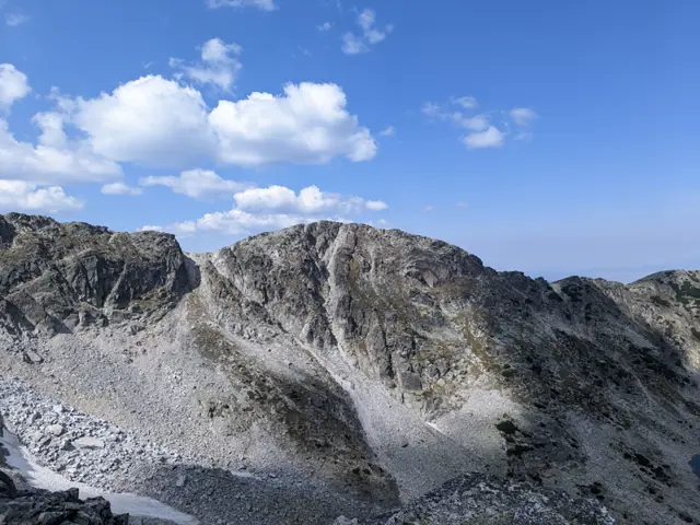
Lyudmil Yankov Peak
2793 mLyudmil Yankov Peak is the fourth-highest peak in Rila. It is located on the main Musala ridge, between Musala and Aleko peaks. The Musala Traverse, a popular route among serious hikers in Bulgaria, passes through it. The peak is named after the legendary Bulgarian mountaineer Lyudmil Yankov, who in 1984, during an expedition to Mount Everest, climbed without supplemental oxygen from 7,170 m to 8,500 m in a single push (a 1,330-meter elevation gain, much of it in the death zone) in an attempt to save Hristo Prodanov. Lyudmil Yankov died in 1988 on another peak in Rila - Kamilata (The Camel).
Росен Пантелеев
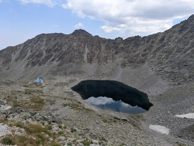
Ledenoto Lake (The Ice Lake) is the first (from top to bottom) of the Musala Lakes group, as well as the highest glacial lake on the Balkan Peninsula. It is located about 300–350 meters northeast below Musala Peak. The lake gets its name because it retains its ice cover longer than any other lake in the group, and even after the ice melts completely, the water remains ice-cold. In the scree slopes high above its shore, patches of snow linger throughout the summer. Ledenoto Ezero Shelter is built near its shore.
Росен Пантелеев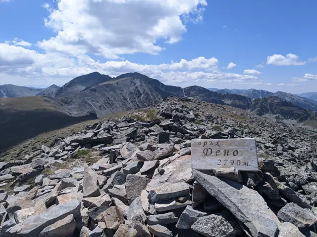
Deno Peak
2790 mDeno Peak is the fifth highest peak in Rila. It is located on the main Musala ridge, alongside the four peaks that surpass it in height: Irechek, Malka Musala, Musala, and Lyudmil Yankov. The trail between the Musala Hut and Chakar Voyvoda Hut passes along its northern slope. From there, you can take a detour to the summit, though this "detour" involves a rather lengthy walk up a steep, grassy slope. The famous "Sphinx" rock formation is located on the peak's southeastern slope.
Росен Пантелеев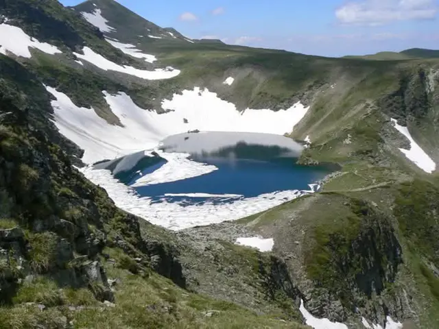
Okoto Lake (The Eye)
2440 mOkoto (The Eye) is the second of the Seven Rila Lakes. Its depth is 37.7 meters, making it the deepest glacial lake on the Balkan Peninsula. It drains from the southern side into Bliznaka Lake (the fourth in the group) via a stream with a small waterfall, alongside which the marked tourist trail passes. Steep rocks and gullies rise above the northern shore of the lake, in which snow patches may remain until late summer.
Росен Пантелеев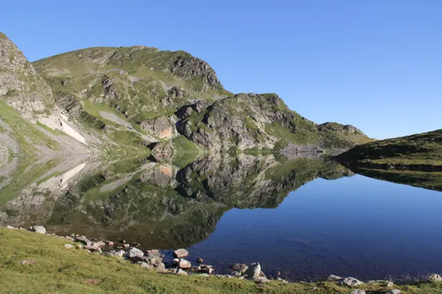
The Kidney Lake is the third (from top to bottom) lake in the group of the Seven Rila Lakes. If you are coming along the red-marked path from the Rila Lakes Hut, it will be the first lake you reach. It is the second deepest lake in the group (after Okoto) - 28 meters.
Росен Пантелеев