Places
+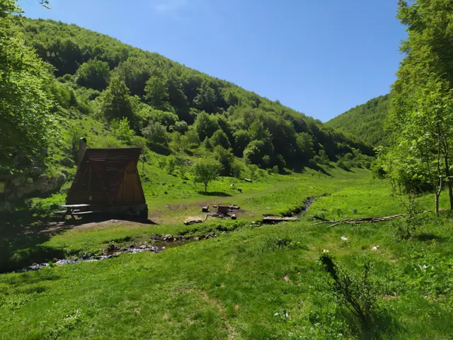
Borov Kamak Shelter
1096 mBorov Kamak Shelter is located in a wide meadow, about a ten-minute walk from the waterfall of the same name.
 Росен Пантелеев
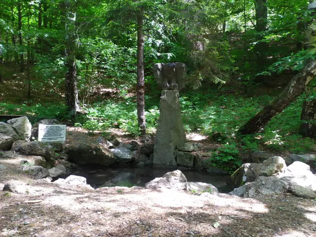
"Kushbunar" spring
980 mKushbunar is a spring in the Sinite Kamani (Blue Stones) Nature Park near Sliven. It is surrounded by centuries-old beech trees.
Росен Пантелеев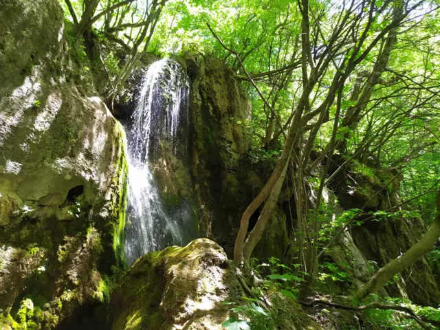
Futula Waterfall
943 mFutula Waterfall is located in the Sinite Kamani (Blue Stones) Nature Park above Sliven. It is accessible from the upper station of the chairlift along a marked trail.
Росен Пантелеев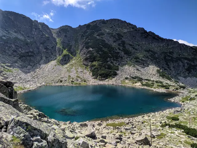
Alekovo Lake
2544 mAlekovo Lake is the third (from top to bottom) of the Musala Lakes group. It is located at the foot of Aleko Peak, and the summer trail from Musala Hut to Musala Peak passes along its shore. Its color varies from dark blue in cloudy weather to turquoise when lit by the sun.
Росен Пантелеев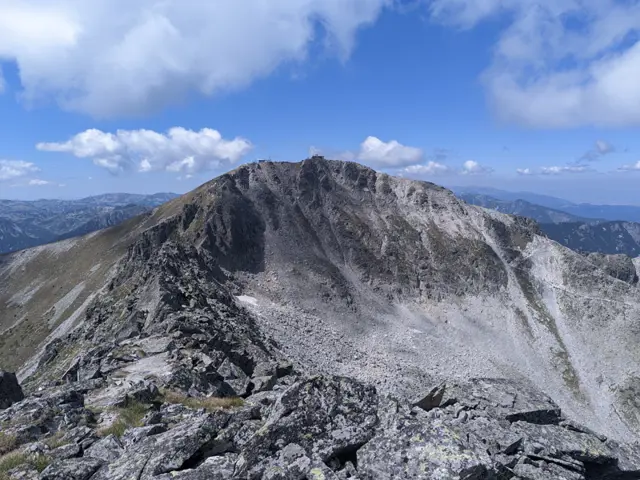
Musala Peak
2925 mMusala is the highest peak in Rila and the entire Balkan Peninsula. In the summer, it is easily accessible via a marked trail with no technical difficulties, starting from the upper station of the "Yastrebets" gondola lift. Its accessibility makes it a top selfie destination, so there are summer weekends when the peak becomes surprisingly difficult to reach.
Росен Пантелеев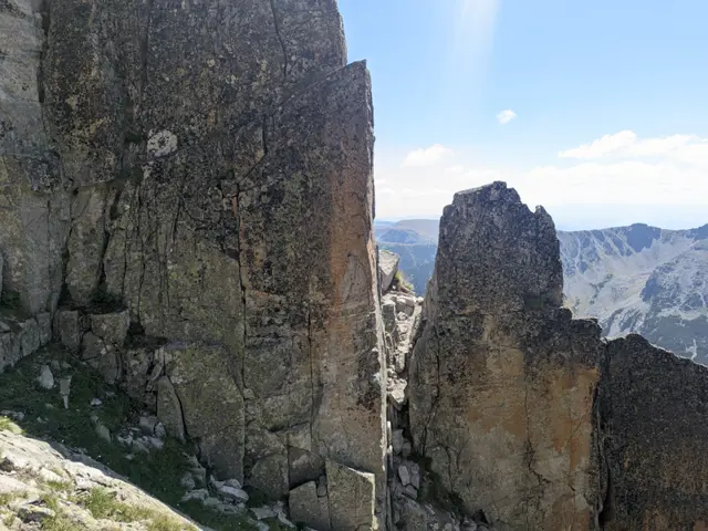
Trionite
2880 mTrionite (The Saws) is a highly jagged rocky ridge that connects Musala Peak with the second-highest peak in the Rila Mountains, Malka Musala. Trionite, along with the northern slope of Malka Musala, are considered the most difficult sections of the classic Musala Traverse.
Росен Пантелеев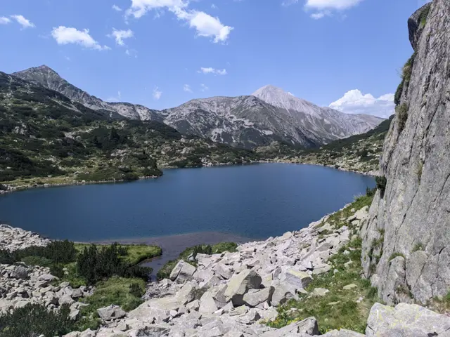
Ribno Banderishko Lake
2195 mThe largest and deepest lake in the Banderishki Lakes group.
Росен Пантелеев
"Singing Rocks" (Peeshti Skali) is a rock formation located on the main ridge of the Balkan Mountains, between the peaks of Valcha Glava (Korubashitsa) and Rosovatets, about an hour away from Mazalat Hut. The trail from Mazalat Hut to Tazha Hut passes through them, which is part of the Kom-Emine long distance trail. They got their name because of the sounds the rocks make when the wind blows through the gaps between them. What these sounds are like, I don't know - I've never heard them, nor do I know anyone who has. But the place is visually interesting, so given the short hike to get there from Mazalat Hut (about an hour), it is well worth a visit.
Росен Пантелеев
Kopitoto
1345 mKopitoto is a steep rocky terrace in the northwestern part of Vitosha Mountain, offering a panoramic view of the entire city of Sofia and featuring a prominent TV tower. An asphalt road reaches Kopitoto, making it a popular starting point for hikes. Numerous marked hiking trails lead here, both from the Knyazhevo and Boyana neighborhoods, as well as from Zlatnite Mostove and nearby huts. The cable car, whose pillars can be seen in some of the photos here, has been out of operation for over thirty years. However, the trail that follows its route was the favorite training path of Boyan Petrov, Bulgaria's most successful high-altitude mountaineer. Since his passing, an annual competition is held there in his honor.
Росен Пантелеев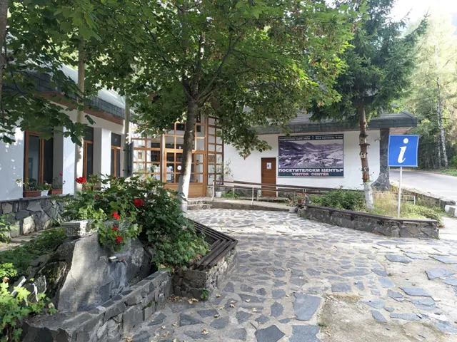
Visitor Center of Rila National Park, including a museum with a rich collection of minerals and a three-dimensional model of Rila.
Росен Пантелеев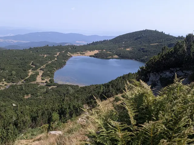
The Lower Lake is the seventh of the Seven Rila Lakes. It is located at the lowest altitude of them all, which is why it was given the most logical name for its position—Dolnoto Ezero means The Lower Lake in Bulgarian. In the Bulgarian mountains, there are many lakes with unique names. Just within the boundaries of the Rila mountains, we can visit The Pig Lake (Svinskoto Ezero), The Stinking Lake (Smradlivoto Ezero), and The Maggoty Lake (Chervivoto Ezero). Compared to these, The Lower Lake does not exactly boast an impressive name. The lake is 11 meters deep. The waters of the other six lakes flow into it, and the lake itself is the source of the Dzherman River.
Росен Пантелеев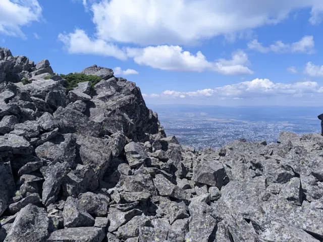
Kamen Del Peak
1862 mKamen Del is the sharp Vitosha peak that can be seen to the left of Kopitoto (where the TV tower sits) from most of Sofia. It is among the most popular places to visit on Vitosha, a popularity boosted by its easy accessibility via a nearly flat trail from Aleko Hut, as well as the panoramic view of the entirety of Sofia that the peak offers. The peak is rocky, with wide and long stone runs cascading down its northern slopes. On its southern side, the peak is relatively gentle, and from the grassy trail that passes by it (from Aleko Hut to Momina Skala Hut and/or Zlatnite Mostove), it takes only a five-minute walk over rocks to reach the summit. South of the peak lie Ushite Shelter and the peak of the same name, while to the southwest, across a wide meadow, is Chernata Skala Peak.
Росен Пантелеев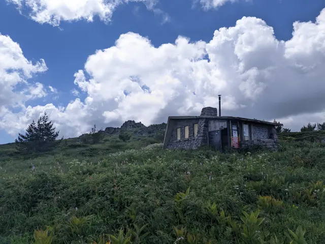
Ushite Shelter
1840 mUshite Shelter is located on the Vitosha plateau, northeast of Ushite Peak and southeast of Kamen Del Peak. The shelter is permanently locked. The only part of it accessible to hikers is its vestibule, which has no door, but its entrance is relatively narrow, so it can provide shelter from the wind during bad weather.
Росен Пантелеев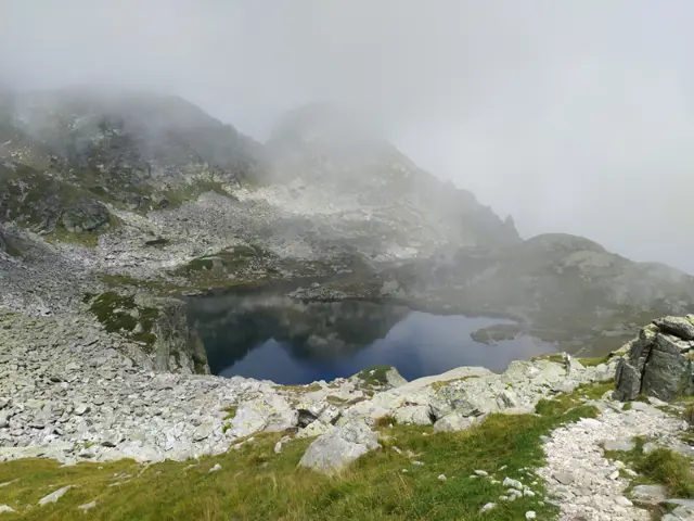
Elenino Lake
2479 mElenino Lake is the largest and most famous of the group of three Elenski (Elenini) Lakes. It is located east of Malyovitsa Peak, right at its foot. The marked trail to the peak from Malyovitsa Hut passes by its shore.
Росен Пантелеев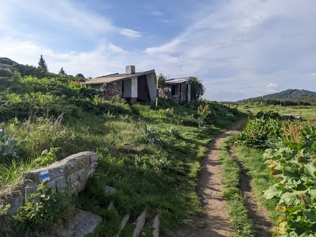
Konyarnika Shelter
1783 mKonyarnika Shelter is located on a wide meadow in the area of the same name, close to the abandoned ski tow. Both the shelter's vestibule and the meadow in front of it feature wooden tables and benches, making the spot a popular resting place during hikes to Cherni Vrah (Black Peak). The trails to Cherni Vrah coming from Kumata Hut and Zvezditsa Hut converge at the shelter. Konyarnika Peak is located about a hundred meters behind the shelter.
Росен Пантелеев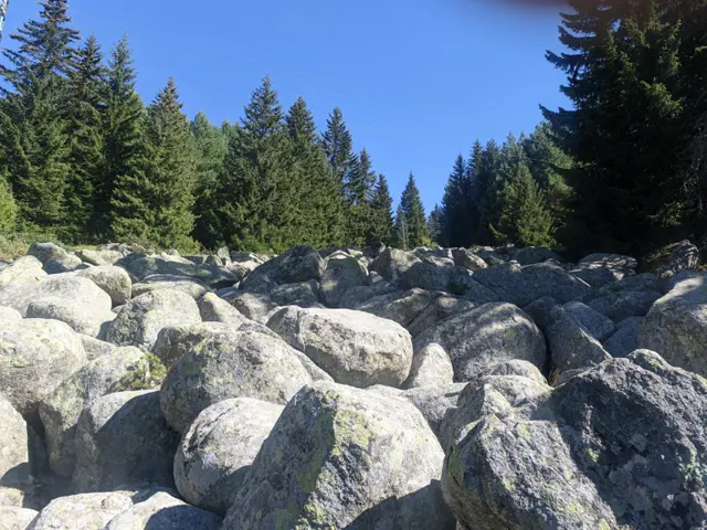
A small stone river located north of Kumata Hut, at the very beginning of the direct trail leading from the chalet to Golden Bridges (Zlatnite Mostove).
Росен Пантелеев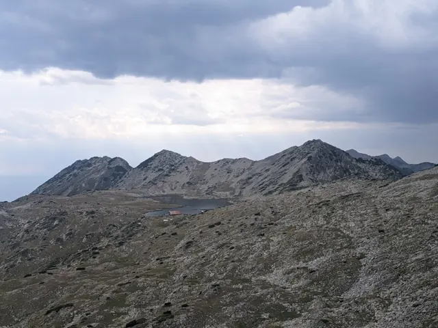
Left Kraledvor Gate
2610 mLeft Kraledvor Gate is located on the main Pirin ridge between the peaks of Kralev Dvor and Momin Dvor. It connects the Kraledvor Cirque with the Belemeto Cirque, where Tevno Lake is situated. Its eastern slopes are steep with unstable boulders, while the western side, facing Tevno Lake, is gentler and rather grassy. The main trail between Bezbog Hut and Tevno Ezero Shelter runs through this pass.
Росен Пантелеев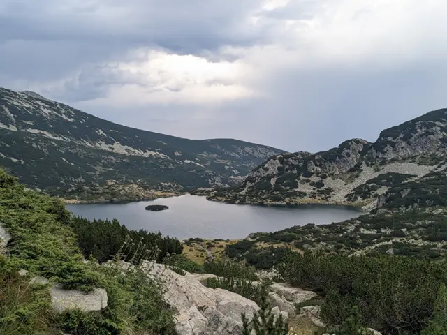
Popovo Lake
2234 mPopovo Lake (Priest's Lake) is located in the Popovo Lake Cirque, which also holds several other smaller lakes. It is the largest lake in Pirin by surface area and depth, the fourth-largest glacial lake in Bulgaria, and the second-deepest after Okoto (The Eye) Lake in Rila. The lake has a small islet in its northern part, which people have likened to a priest’s cap. Access to the lake is relatively easy, as a well-trodden and marked trail leads to it from Bezbog Hut, taking about an hour and a half each way. Although relatively straightforward, this trail still involves some climbing and descending. The section right after Bezbog Lake is known as the 'dushegubka' (soul-crusher). This is mainly because hikers tend to head straight up the steep, eroded slope instead of using the green-marked switchback trail that winds up gradually.
Росен Пантелеев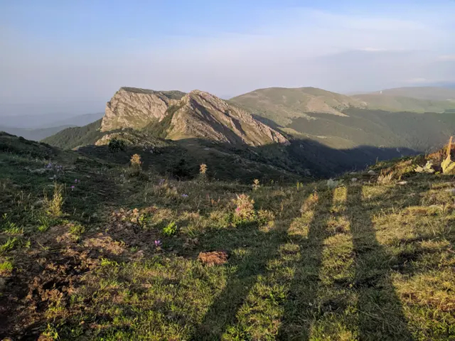
Kozya Stena Peak
1670 mKozya Stena Peak is located on the main Stara Planina ridge in a reserve with the same name. The winter path from Beklemeto to Kozya Stena Hut, secured with a metal rope, passes through the peak and is often used in the summer too. The area is one of the few localities of edelweiss in Bulgaria, and the edelweiss here (Leontopodium nivale subsp. nivalis) is a different subspecies from those found in Pirin.
Росен Пантелеев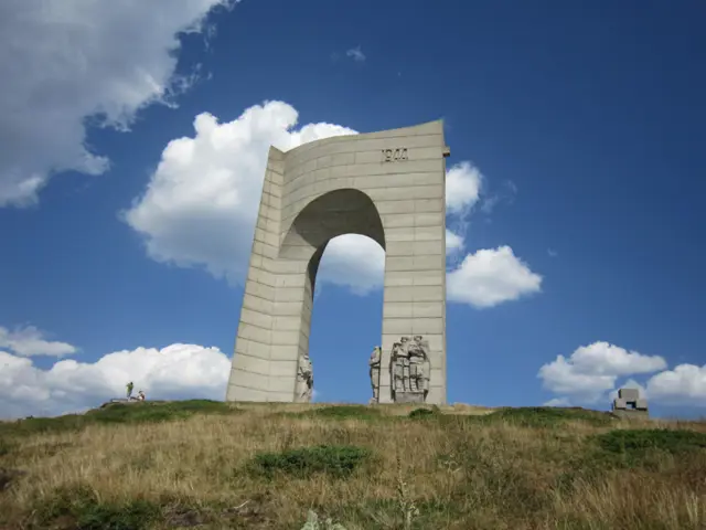
Arch of Freedom
1593 mUpon the "Arch of Freedom" monument, there are two dates - the year 1878, when after the Russo-Turkish War Bulgaria was liberated from Ottoman rule, and the year 1944, when after a military occupation Bulgaria was liberated from freedom, falling into the sphere of influence of the Soviet Union.
Росен Пантелеев