Places
+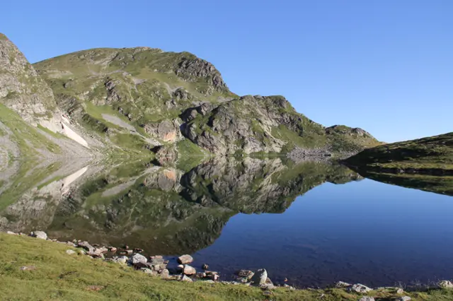
The Kidney Lake is the third (from top to bottom) lake in the group of the Seven Rila Lakes. If you are coming along the red-marked path from the Rila Lakes Hut, it will be the first lake you reach. It is the second deepest lake in the group (after Okoto) - 28 meters.
 Росен Пантелеев
Bliznaka Lake
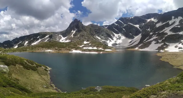
2243 mBliznaka (The Twin) is the fourth of the Seven Rila Lakes group. It consists of two parts connected by a narrow strait, which gives the lake its name. It is the third deepest lake after Okoto (The Eye) and Babreka (The Kidney), with a depth of 27.5 meters, but it is the largest by surface area. It collects water from the three lakes located above it and drains into Trilistnika (The Trefoil) Lake.
Росен Пантелеев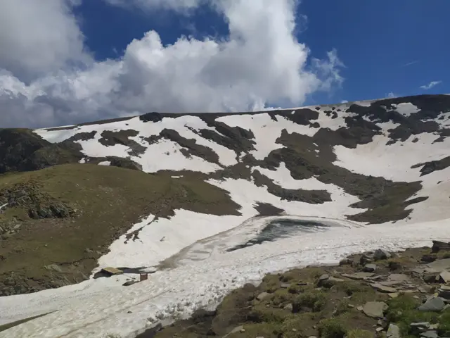
Salzata Lake (The Tear)
2535 mThe Tear (Salzata) is the highest (from top to bottom) of the Seven Rila Lakes. It is the smallest lake in the group by surface area and the second shallowest (4.5 meters) after the Fish Lake (Ribnoto). It drains into the southern part of the Twin Lake (Bliznaka).
Росен Пантелеев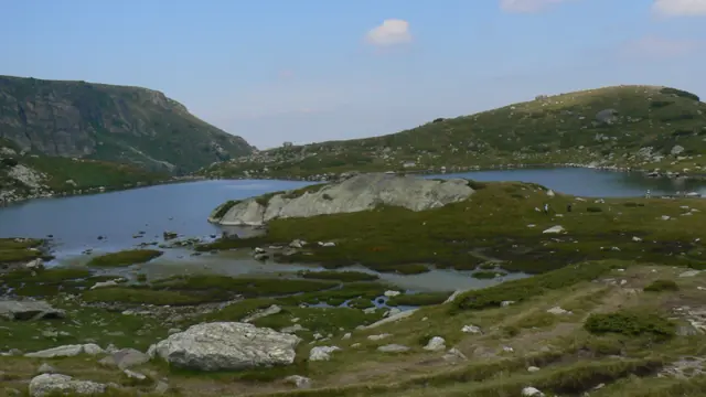
Trilistnika (The Trefoil) is the fifth lake in the Seven Rila Lakes group. It is supplied with water from Lake Bliznaka (The Twin), as well as from streams with their own springs. Two streams originate from it: a southeastern one, which turns northeast and flows into Ribnoto Lake (The Fish Lake) located below it, and a northwestern one, which crosses the trail between the Seven Lakes Hut and the Rilski Ezera Hut. The second stream is considered to be the source of the German River.
Росен Пантелеев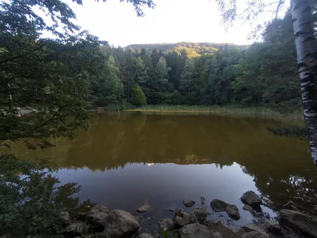
Boyana Lake
1037 mBoyana Lake is an artificial body of water on Vitosha Mountain, located about 1.5 km southeast of Sofia's Boyana neighborhood. It was created during the construction of the Vitosha water supply system for Sofia in 1906, prior to which the site was a marshland. The lake can be reached from Boyana via a trail that branches off from the one leading to the Boyana Waterfall, as well as via the Low-Mountain Ring Trail, which can then be followed to continue toward the Dragalevtsi Monastery.
Росен Пантелеев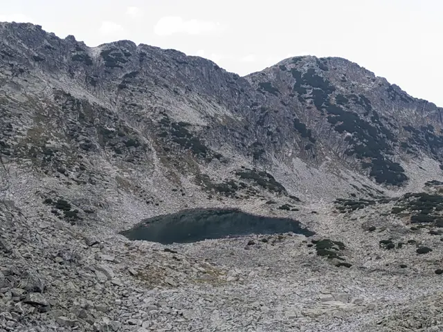
Upper Musala Lake
2576 mUpper Musala Lake is the second (from top to bottom) of the Musala Lakes group. It is located below Lyudmil Yankov Peak, formerly known as Bezimenen (Nameless) Peak, which is why hikers also refer to this lake as Bezimiennoto by association."
Росен Пантелеев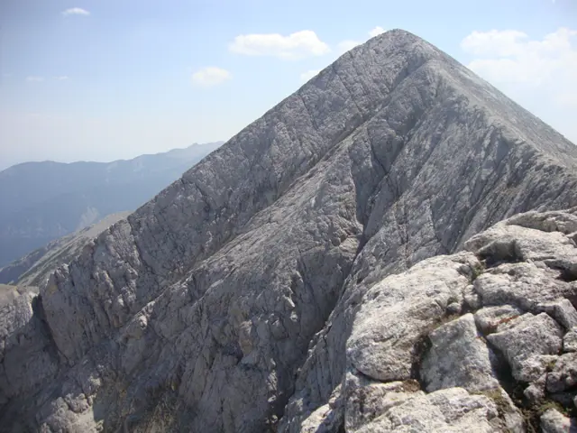
Kutelo Peak
2908 mKutelo is the second highest peak in Pirin, the third highest in Bulgaria, and the fifth highest on the Balkan Peninsula. It is located on the marble ridge north of Vihren Peak. The Koncheto karst ridge begins northwest of it. To the southeast lies the Kazana cirque along with the shelter of the same name. The peak has two summits, which are sometimes designated as Kutelo 1 and Kutelo 2.
Росен Пантелеев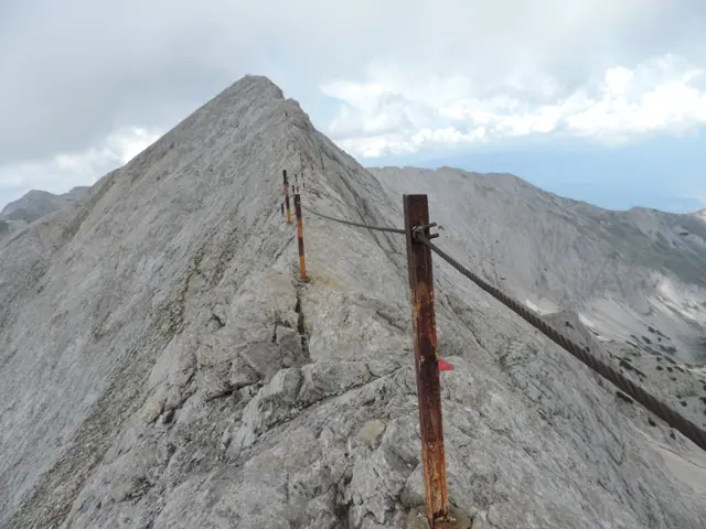
Koncheto
2810 mKoncheto ("The Little Horse") is a knife-edge ridge in Pirin. It lies on the main mountain backbone between the peaks of Kutelo and Banski Suhodol. Its northeastern slopes are almost vertical. They drop more than 400 meters into the dry Banski Suhodol cirque. The southwestern slope is less steep. However, a fall from this side can still be fatal. At its narrowest point, the ridge is only about half a meter wide. In the past, when the metal safety cable that now runs along it was not yet installed, hikers used to cross these narrow parts by straddling the rock as if riding a horse. This is how Koncheto got its name. The length of the ridge is about 400 meters, which means that crossing it requires at least twenty minutes of complete concentration - something that might not be entirely easy to achieve after four to five hours of prior hiking, which is how long it takes to reach it. On summer weekends, Koncheto is heavily visited, and passing hikers coming from the opposite direction along the narrowest sections can put an extra strain on your nerves. In autumn, the ridge can partially freeze over, especially in the evening, making the already polished rock even more slippery. The red-marked trail between Yavorov Hut and Vihren Hut crosses Koncheto. This trail is part of the European long-distance path E4.
Росен Пантелеев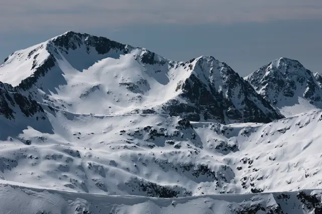
Kamenitsa Peak
2822 mKamenitsa Peak is the fifth-highest summit in Pirin and the highest peak on the Kamenitsa side ridge, which branches off from the main Pirin ridge at Kralev Dvor Peak. When viewed from Tevno Ezero, the lower Kamenishka Kukla (2,690 m) is visible to the right (to the west). Both peaks and the lake in front of them are a favorite subject for landscape photographers.
Росен Пантелеев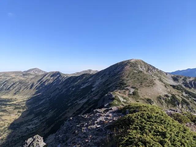
Shishkovitsa Peak
2669 mShishkovitsa Peak is located in the central part of Rila, on the ridge connecting the peaks Vazela and Venetsa. It is a difficult-to-access peak, as there are no official tourist trails leading to it, and the unofficial paths pass through rocky sections, steep meadows covered in juniper, and slopes overgrown with dwarf pine. The name of the peak comes from the Bulgarian word shishko, which is a humorous term for an overweight person.
Росен Пантелеев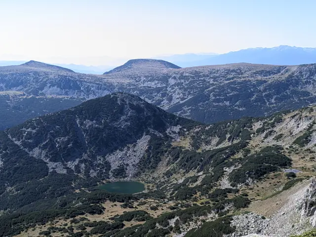
Chervivoto Lake
2320 mI don't know who named this lake Chervivoto (The Wormy/Maggoty Lake) or why, but it holds a worthy place in the long list of poetic names for beautiful locations in Rila, competing with Smradlivoto Ezero (Stinky Lake), Svinskото Ezero (Pig's Lake), and Shishkovitsa Peak (The Obese Peak). The lake is located between the peaks Shishkovitsa and Zeleni Vrah. It is the larger and clearly more noticeable one of the pair of Chervivi Lakes, the smaller of which is truly tiny and is located near the ridge between the peaks Shishkovitsa and Venetsa.
Росен Пантелеев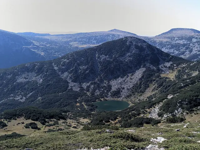
Zeleni (Green) Peak
2532 mZeleni Vrah (Green Peak) is located in Central Rila, east of Venetsa Peak, south of Shishkovitsa Peak, and southwest of the Beli Iskar reservoir. The Zelenovrashki Lakes lie at its southwestern foot, while Chervivoto Ezero (The Wormy Lake) is situated to its north. The peak is rocky and overgrown with dwarf pine, and there are no marked tourist trails leading to it.
Росен Пантелеев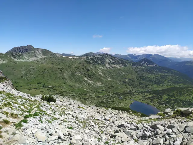
Kanarsko Lake
2260 mKanarata Lake is located between the peaks Kanarata, Yosifitsa, and Venetsa. It is the lake that can be seen down in the valley when bypassing Kanarata Peak along the marked trail between Granchar Hut and Ribni Ezera Hut.
Росен Пантелеев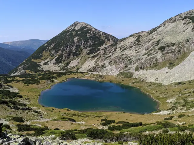
Blue Lake
2416 mThe Blue Lake (Sinyoto Ezero) is located in the southern part of the Mermer Circus, not far from the Rilets Ridge. It is the largest of the group of four Karaomeritsa Lakes and, together with the pyramidal Mermer Peak rising above it, is one of the standout landscapes along the marked trail from Ribni Ezera (Fish Lakes) Hut to Makedoniya Hut.
Росен Пантелеев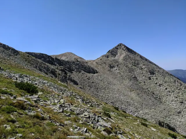
Pavlev Peak
2682 mPavlev Peak (Pavlev Vrah) is located on the main ridge of Rila, between the peaks of Karaalanitsa (Cherna Polyana) and Kanarata. The marked trail between Ribni Ezera (Fish Lakes) Hut and the Macedonia Hut, which is part of the E4 European long-distance path, passes over it. In the section before the summit (coming from Ribni Ezera), the trail is secured with a steel cable and is known as the Rila Konche - by analogy with the Koncheto rock ridge in Pirin, which is also secured with a cable. However, unlike Koncheto in Pirin, the ridge that the trail follows over Pavlev Peak is much wider, and if the rocks are dry in the summer, there is no need to hold onto the cable.
Росен Пантелеев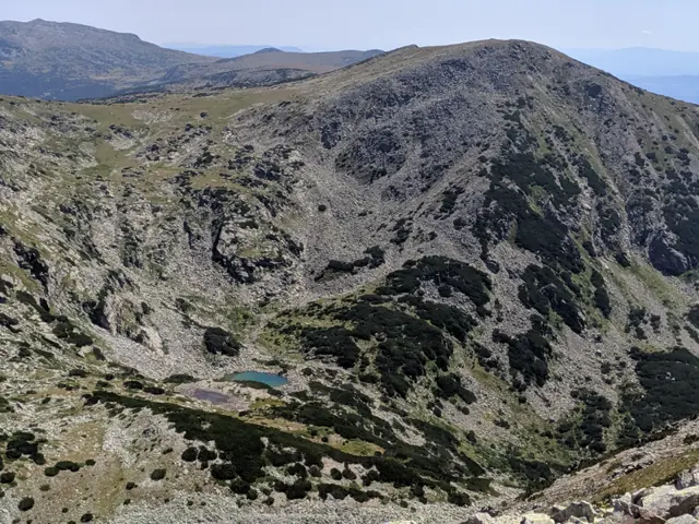
Redzhepitsa Peak
2678 mRedzhepitsa Peak is located on a ridge branching south from the main ridge of Central Rila at Kanarata Peak. The Redzhepski Lakes lie to its south, and the Upper Vapsko Lake is to its east.
Росен Пантелеев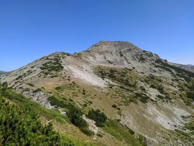
Karaalanitsa Peak is located on the main Rila ridge between the peaks of Pavlev and Aladzha Slap. The marked trail between Ribni Ezera (Fish Lakes) Hut and Makedoniya Hut, which is part of the E4 trail, passes through the peak.
Росен Пантелеев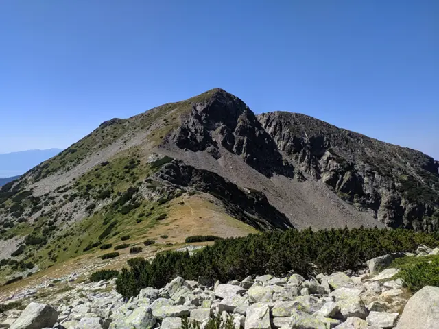
Aladzha Slap Peak
2695 mAladzha Slap Peak is located in Central Rila, on the ridge between the peaks of Karaalanitsa and Angelov Vrah. The marked trail between Makedoniya Hut and Ribni Ezera (Fish Lakes) Hut passes through it. The ascent from Makedoniya Hut is notorious for its steepness, as the trail goes straight up without any switchbacks, gaining nearly 300 meters of elevation. The winter trail goes directly over the peak, while the summer trail bypasses its highest point from the east.
Росен Пантелеев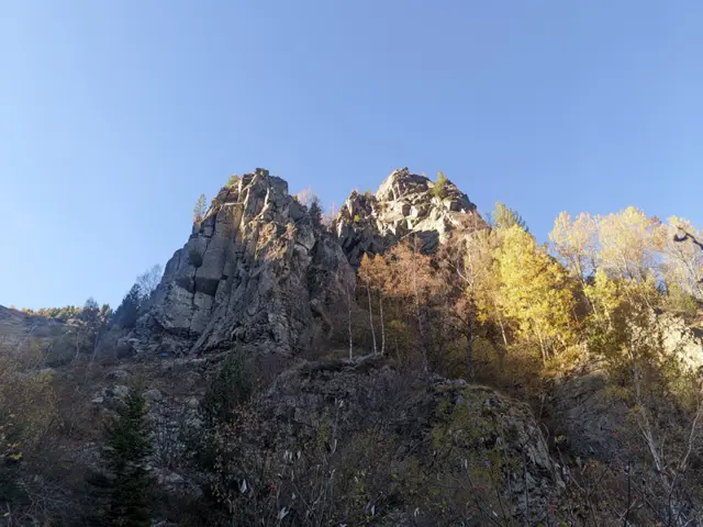
Kominite (The Chimneys)
1670 mKominite (The Chimneys) are two rock towers located on the northeastern slope of Vitosha Mountain. Below their near-vertical eastern walls, which are a popular rock climbing destination, flows the upper reach of the Dragalevska River. They can be reached from Bai Krastyo Shelter via a trail that continues past them toward the plateau and the peaks of Ushite and Kamen Del. It is possible to hike up to the highest point of the rock formation, located west of the sheer cliffs, without any specialized climbing gear. A short detour from the plateau trail leads to this spot. In the winter, the area around them is prone to avalanches.
Росен Пантелеев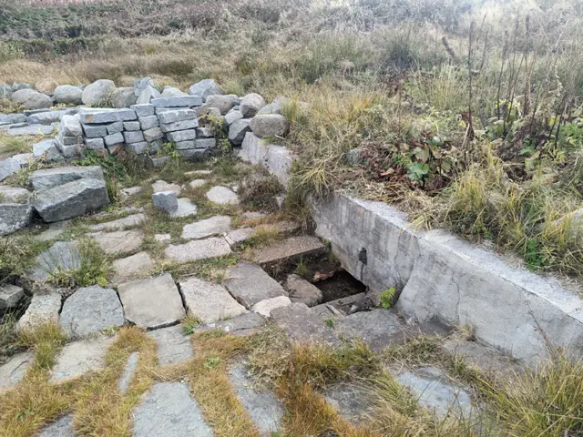
Manova Cheshma (Manov's Water Fountain) is located on the trail that connects the Plateau with Kominite and Kikish Shelter. Unfortunately, the fountain is not maintained and is falling into ruin, although the spring next to it remains active.
Росен Пантелеев