Places
+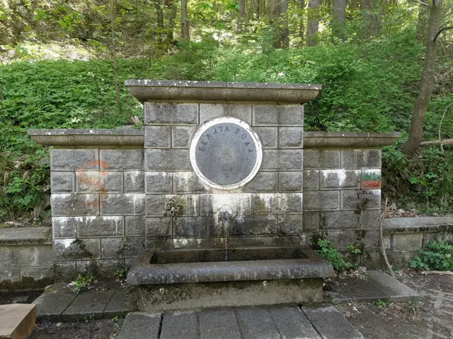
Byalata Voda Fountain (literally translated as White Water) is located at an altitude of about 988 m in the valley of a small tributary of the Vladayska River. Next to the fountain is a recreation area with benches and tables. Hiking trails to Zlatnite Mostove, Kopitoto, Tikhia Kat or the Bear Museum all start from here. The "Belovodski Way", a street named after the fountain, also ends here.
 Росен Пантелеев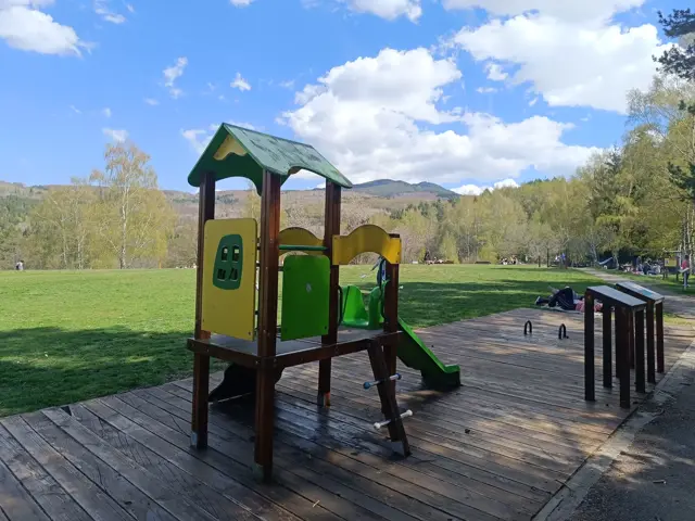
Dendrariuma Area
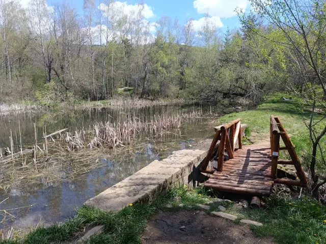
1201 mAn area with botanical alleys, gazebos, ponds and children's areas.
Росен Пантелеев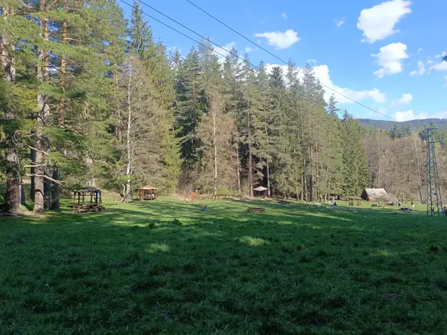
Mochurlivata Polyana
1405 mMochirlivata Polyana (The Swampy Meadow) is a meadow with gazebos and a concrete shelter with a fireplace in the area of Zlatnite Mostove.
Росен Пантелеев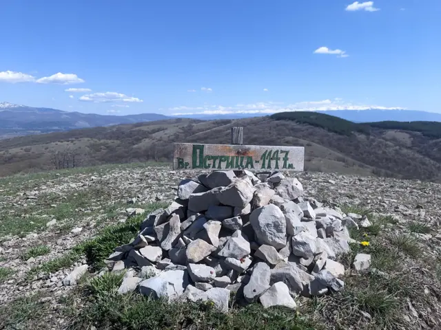
Ostritsa Peak
1147 mOstritsa Peak is located in the reserve of the same name, which is one of the oldest protected areas in Bulgaria. From the top, a panorama opens up to Vitosha, Rila, Lyulin and the mountains in Kraishte.
Росен Пантелеев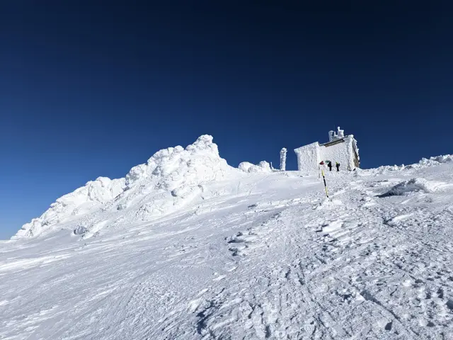
Samara Shelter
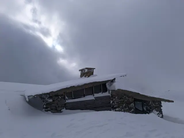
2062 mShelter at the foot of Vrah Samara. It has a vestibule and two rooms, one of which has a bunk-style bed.
Росен Пантелеев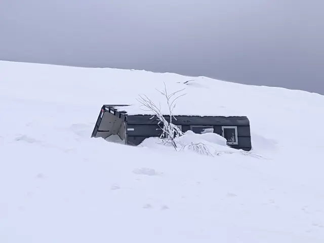
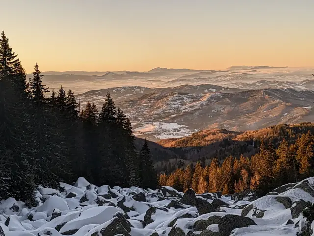
Very close to the hut complex, which includes Planinarska Pesen Hut, Borova Gora Hut, and the defunct Boeritsa Hut, at the foot of Chernata Skala Peak, there is a stone river from which you can watch some of the most beautiful sunsets on Vitosha.
Росен Пантелеев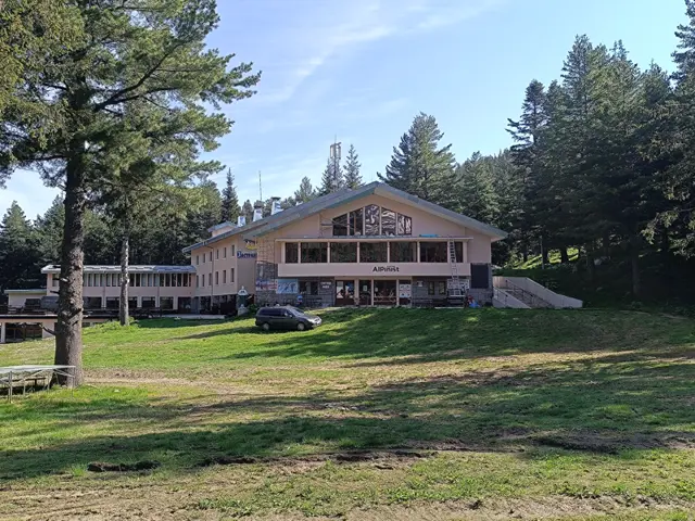
Hotel Alpinist
1712 mPreviously known as ЦПШ (Central Mountain School). Now it is a hotel.
Росен Пантелеев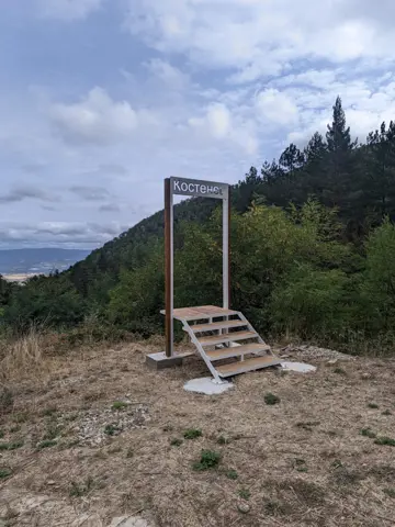
That's not a gallows, don't judge too quickly. That's a frame in which a person can have his photo taken by a friend, with an aerial view of the valley as a background.
Росен Пантелеев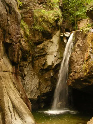
Kostensky Waterfall
860 mKostenets Waterfall is just a five-minute walk from the parking lot in front of the Kostenets Therme, making it an easy walk for families with small children. The waterfall is formed by the Chavcha River, which originates near Ibar Peak - the highest peak in Eastern Rila. The waterfall is about ten meters high. It carries the most water in spring due to melting snow, and it usually freezes over in the winter. The famous Bulgarian writer Ivan Vazov wrote about this spot in his poems 'The Waterfall Weeps' and 'Above the Waterfall' (Yulska Kitka, 1917), as well as in a 1906 short story. Today, you can read an excerpt from 'Above the Waterfall' on a wooden sign near the mineral water fountain at the start of the trail. You can learn more at https://www.kostenskivodopad.bgsait.com/.
Росен Пантелеев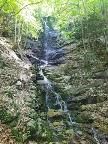
Skalovitets Waterfall is located in Eastern Rila along a tributary of the Ribnitsa River. Standing roughly 25 meters tall, the waterfall cascades down three tiers, with the middle step being the largest and steepest.
Росен Пантелеев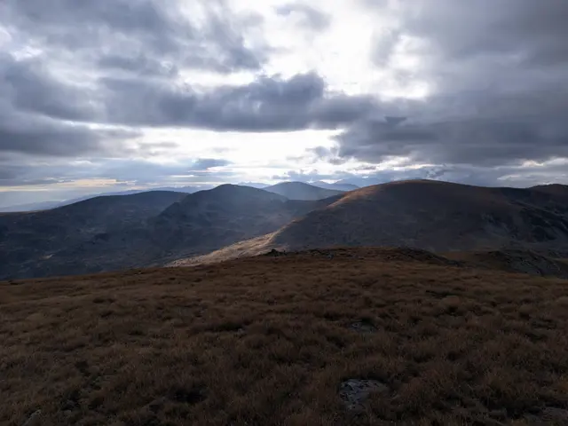
Belmeken Peak
2626 mBelmeken is the peak after which the Belmeken section of Rila is named. At its foot is the Belmeken Dam. The northern slope is steep, rising above the Kutlinite Circus. In clear weather and good visibility, views in all directions are open from the summit. One can see Pirin with Vihren Peak, Slavyanka with Gotsev Peak, Vitosha with Kamen Del, Stara Planina, Sredna Gora, the Western Rhodopes, the Iskar and Batak Dams, as well as the Belmeken Dam located at its foot. Near the peak is the highest mountain colony of the European ground squirrel (Spermophilus citellus) in Bulgaria and the entire Balkan Peninsula.
Росен Пантелеев
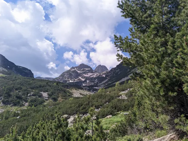
Malyovitsa peak
2729 mMalyovitsa is one of the most visited alpine peaks in Bulgaria. The Malyovitsa section of Rila (including the Malyovitsa Ridge, the Seven Rila Lakes, and the Urdini Lakes) is named after it. It is not, however, the highest peak in its section. The highest peak is Golyam Kupen, which is one of the peaks, forming the crown of Strashnoto Lake.
Росен Пантелеев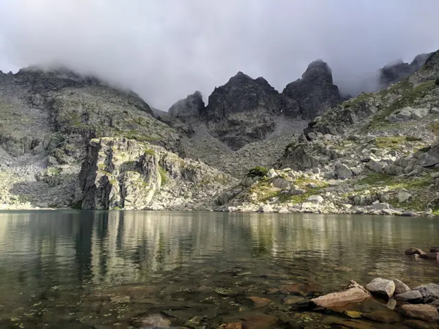
Strashnoto Lake
2462 mStrashnoto Ezero (The Scary Lake) is a glacial lake situated beneath a crown of rocky peaks, including Golyam Kupen - the highest peak of the Malyovistsa section of Rila. A stone shelter, named after the lake, has been built next to its shore. The most common question about Strashnoto Ezero is what makes it so scary. The answer: nothing in particular. Years ago, before the shelter by the lake was built, a painter from Samokov named Hristo Yonchev-Kriskarets was caught in a thunderstorm up there and got terrified. He told his friends about the incident and how scary it was, and that is how the lake got its name. Whether this story is true we do not know, but we can say with certainty that Yonchevo Ezero (Yonchev's Lake), located about an hour below Strashnoto Ezero, is indeed named after Hristo Yonchev.
Росен Пантелеев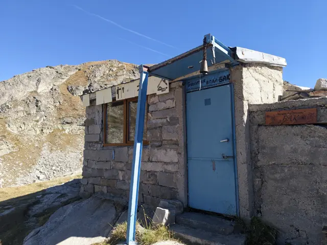
Granitna Voda Shelter, also known as BAK or Orlovets Shelter, is located on a small knoll in the center of the cirque, which is surrounded by the peaks of Orlovets, Zliya Zab, Lovnitsa, and Kamilata. It consists of an anteroom and a small common area featuring two-tiered wooden bunks for sleeping. The shelter is known by all three names due to its history - both its own and that of its location. Not far from Granitna Voda, beneath Orlovets Peak, lies a sloping rock with a stone wall closing off its entrance. This was the area's first shelter, built in the 1930s by members of the Bulgarian Alpine Club of that era. On one of the stones at its entrance, the shelter's builders carved the acronym BAK in the Latin alphabet. Decades later, the Orlovets Shelter was built on the site where Granitna Voda stands today. It was a large structure with a wooden frame and concrete foundations. In the 1980s, the shelter burned down, and later, in its place, the mountaineer Milcho Ladov built the current structure. He named it "Granitna Voda" (Granite Water) after a poem by legendary mountaineer Lyudmil Yankov, who lost his life beneath Kamilata Peak. Thus, the shelter took its present name in honor of Lyudmil Yankov. Among hiking and mountaineering circles, however, the acronym BAK is used to refer not only to the old shelter but also to Granitna Voda, and sometimes even to the entire surrounding area. The concrete platform next to the shelter is actually the foundation of the burned-down Orlovets Shelter. The Bulgarian Alpine Club is abbreviated here as BAK rather than BAC. This retains the original Latin-script acronym carved into a stone at the entrance by the shelter's 1930s builders. The acronym likely drew from the German spelling.
Росен Пантелеев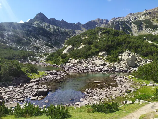
Ovinato Lake
2303 mThis lake is the second largest of the group of Hvoinati (Ovinati) lakes, to which the popular Muratovo Lake belongs. Unlike Muratovo Lake, the other Hvoinati lakes do not have official names, so the name used here is indicative.
Росен Пантелеев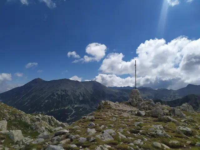
Banderishka Porta
2501 mBanderishka Porta (Gate) is a saddle located between Muratov Peak and Donchovi Karauli and connects Banderishka Circus with Spano Pole. A marked route passes through it, leading from Vihren hut to Sinanitsa hut or Spano Pole shelter. From the gate, you can climb the panoramic Muratov Peak, as well as the rocky ridge of Donchovi Karauli.
Росен Пантелеев