


Balkanity Hut
Balkaniti Hut is located in the area of "Beli Breg," about a 15-minute walk from the Golden Bridges. The hut has an outdoor terrace offering a picturesque view of the Vladaiska River Valley and the forested hills above it, although the river itself is not visible. In front of the hut, there is a meadow with benches and a barbecue, as well as an outdoor…
Amenities
Nearby Places
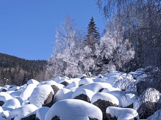
Zlatnite Mostove
1405 m"Zlatnite Mostove" (The Golden Bridges) is the largest stone river on Vitosha Mountain. It is located at an altitude of 1,350 to 1,500 meters, and beneath its rocks flows the Vladayska River - the very same one that flows under the Lions' Bridge in Sofia. Some people wonder about this, so let me clarify: the Golden Bridges are neither golden, nor are they actually bridges. Yes, it often happens that someone stands right in front of them and asks where the bridges are. According to Wikipedia, the golden color in the name comes from the color of the lichens on the stones, but to me, the lichens look more like green, so I don't know. However, an interesting fact is that the figurative name of the area still holds a fraction of literal truth — there are very real golden grains in the sands of the Vladayska River, which flows under the Bridges. They are very rare, but they do exist. If you look closely at the sand at the bottom, especially on a sunny day, you will see golden glittering particles. That is not gold. That is mica, which is light and floats to the very top of the sand. Gold is heavy and sinks. You won't see it. The Golden Bridges are a stone river (or a stone run). A stone river simply means a long scree of large rocks, beneath which a river may or may not flow. The Golden Bridges happen to be a stone river that an actual river runs underneath.

Kopitoto
1345 mKopitoto is a steep rocky terrace in the northwestern part of Vitosha Mountain, offering a panoramic view of the entire city of Sofia and featuring a prominent TV tower. An asphalt road reaches Kopitoto, making it a popular starting point for hikes. Numerous marked hiking trails lead here, both from the Knyazhevo and Boyana neighborhoods, as well as from Zlatnite Mostove and nearby huts. The cable car, whose pillars can be seen in some of the photos here, has been out of operation for over thirty years. However, the trail that follows its route was the favorite training path of Boyan Petrov, Bulgaria's most successful high-altitude mountaineer. Since his passing, an annual competition is held there in his honor.
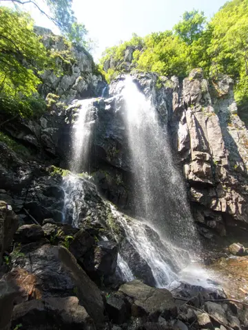
Boyana Waterfall
1260 mthrough Momina Skala Hut
With a height of 25 meters, the Boyana Waterfall is the tallest on Vitosha and one of the most visited places in the mountain. It is located above the Boyana neighborhood in the steep valley of the Boyana River, at an altitude of 1,260 meters. It can be reached via marked trails from the Boyana neighborhood, as well as from the Kopitoto area and Momina Skala Hut. The rocks around the waterfall are wet and slippery in the summer and freeze over in the winter, which is why accidents frequently happen in the area.
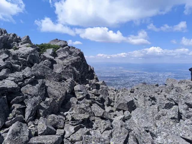
Kamen Del Peak
1862 mKamen Del is the sharp Vitosha peak that can be seen to the left of Kopitoto (where the TV tower sits) from most of Sofia. It is among the most popular places to visit on Vitosha, a popularity boosted by its easy accessibility via a nearly flat trail from Aleko Hut, as well as the panoramic view of the entirety of Sofia that the peak offers. The peak is rocky, with wide and long stone runs cascading down its northern slopes. On its southern side, the peak is relatively gentle, and from the grassy trail that passes by it (from Aleko Hut to Momina Skala Hut and/or Zlatnite Mostove), it takes only a five-minute walk over rocks to reach the summit. South of the peak lie Ushite Shelter and the peak of the same name, while to the southwest, across a wide meadow, is Chernata Skala Peak.
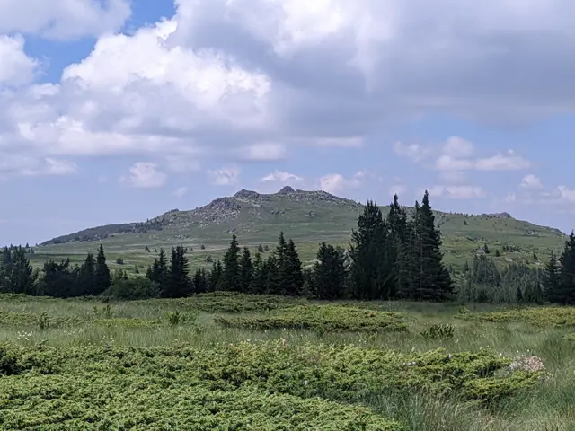
Ushite Peak
1906 mUshite Peak (The Ears) is a twin peak in the northern part of Vitosha, situated south of its neighbor, Kamen Del Peak. Located at its foot is the Ushite Shelter, from which a short path leads to the summit. The peak is most frequently climbed from the direction of Aleko Hut, from where you walk along the nearly flat trail toward Kamen Del Peak and take a left turn at the Ushite Shelter (a few meters after passing it). It is also possible to climb it from the direction of Zlatnite Mostove (The Golden Bridges) or Momina Skala Hut, where the same trail coming from Aleko Hut continues. Climbing the peak from Bai Krastyo Shelter via Kominite, as well as from Kikish Shelter, is significantly more difficult. From both locations, the trails leading to the plateau and the summit cross alpine terrain; they are not well-marked, require good navigation skills, and are prone to avalanches in the winter.
Dendrariuma Area
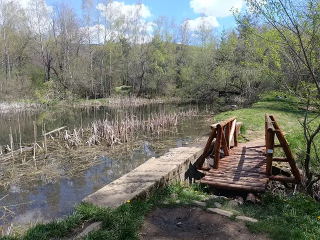
1201 mAn area with botanical alleys, gazebos, ponds and children's areas.
Access Points
via the trail to the Golden Bridges